
Intercommunality Pays Saint-Serninois Area 9.8 km² | Region Occitanie Population (2010) 104 Local time Tuesday 8:52 PM | |
 | ||
Weather 4°C, Wind W at 23 km/h, 93% Humidity | ||
Part 5 of 6 balaguier sur rance aveyron 12 france terrain a vandre
Balaguier-sur-Rance is a French commune in the Aveyron department in the Occitanie region of southern France.
Contents
- Part 5 of 6 balaguier sur rance aveyron 12 france terrain a vandre
- Map of 12380 Balaguier sur Rance France
- Part 4 of 5 balaguier sur rance aveyron 12 france terrain a vandre
- Geography
- Administration
- Demography
- Sites and Monuments
- Notable people linked to the commune
- References
Map of 12380 Balaguier-sur-Rance, France
The inhabitants of the commune are known as Balaguiérois or Balaguiéroises.
Part 4 of 5 balaguier sur rance aveyron 12 france terrain a vandre
Geography
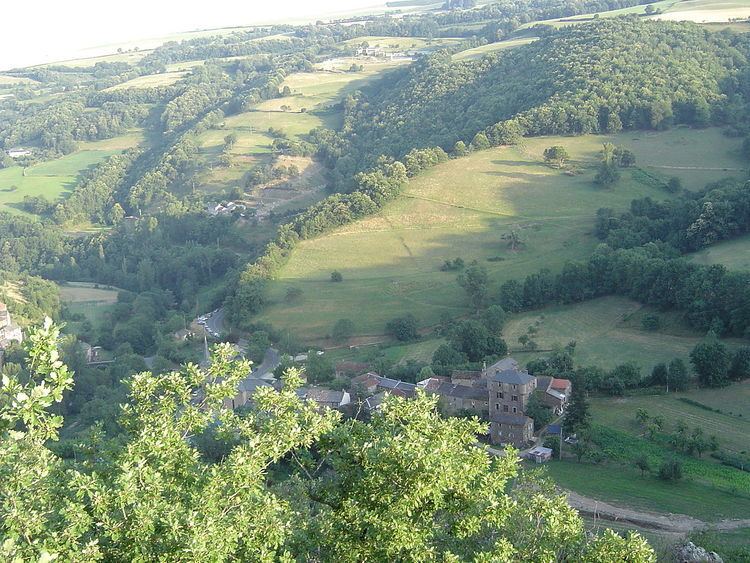
Balaguier-sur-Rance is located some 32 km east of Albi and just north of Saint-Sernin-sur-Rance. The whole western border of the commune is the departmental boundary between Aveyron and Tarn. The commune is divided into two parts situated on either side of the Rance river. Balaguier le Maigre (the thin) or le Vieux (the old) is on the right bank with its houses clinging to a rocky outcrop that supported a fortified structure of which there remains no trace. On the left bank is Balaguier le Gras (the fat) with the church, the town hall, and a chateau from the 15th and 16th centuries. Both banks are connected by a stone bridge from the 15th century. Access to the commune is by the D33 road from Curvalle in the north-west which passes through the commune and the village and joins the D999 on the communal border then continues to Saint-Sernin-sur-Rance. The D999 passes through the south of the commune as it goes from Alban to Vabres-l'Abbaye.
The Rance river flows through the centre of the commune from east to west where it continues north-west to join the Tarn east of Trébas. Many tributaries rise in the commune on both banks of the Rance and flow into it.
Administration
List of Successive Mayors
(Not all data is known)
Demography
In 2010 the commune had 104 inhabitants. The evolution of the number of inhabitants is known from the population censuses conducted in the commune since 1793. From the 21st century, a census of communes with fewer than 10,000 inhabitants is held every five years, unlike larger communes that have a sample survey every year.
Sources : Ldh/EHESS/Cassini until 1962, INSEE database from 1968 (population without double counting and municipal population from 2006)