
Population 770 (2006 census) Local time Wednesday 4:01 AM | Postcode(s) 4740 Postal code 4740 | |
 | ||
Weather 27°C, Wind SE at 16 km/h, 77% Humidity | ||
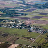
Bakers Creek is a locality in the Mackay Region, Queensland, Australia.
Contents
Map of Bakers Creek QLD 4740, Australia
Geography
Bakers Creek is located 8 kilometres (5.0 mi) south of Mackay on the Bruce Highway. The Bakers Creek watercourse runs through the township.
At the 2006 census, Bakers Creek had a population of 770.
Economy
The main industry is a large meat processing plant operated by Thomas Borthwick & Sons (Aust) Pty Ltd.
History
The locality was named after the creek, which in turn was named after John T. Baker, a customs officer in Mackay in 1863.
Dundula State School opened on 28 August 1922 with 37 children enrolled on the first day, with 45 enrolled by the end of 1922. The first headmaster was Courtney Hoffman.
Bakers Creek Post Office opened on 1 July 1927 (a receiving office had been open since 1909) and closed in 1979.
In 1943, a USAAF aircraft crashed in the locality, killing 40 of the 41 people on board. The Bakers Creek air crash is Australia's worst aviation disaster by death toll. A memorial to the disaster was built in 1981 and is located in the grounds of the Bakers Creek Community Hall.