
Country United States Time zone Eastern (EST) (UTC-5) FIPS code 13-04896 Area 52 km² Population 12,597 (2013) Area code 229 | County Decatur ZIP code 39817,39819 GNIS feature ID 0354431 Elevation 37 m Local time Tuesday 10:46 AM University Bainbridge State College | |
 | ||
Weather 21°C, Wind SE at 10 km/h, 74% Humidity | ||
Bainbridge is a city in Decatur County, Georgia, United States. The city is the county seat of Decatur County. As of the 2010 census, the city had a population of 12,697.
Contents
- Map of Bainbridge GA USA
- History
- Geography
- Demographics
- Annual cultural events
- National Register of Historic Places
- Decatur County School District
- Transportation
- Notable people
- References
Map of Bainbridge, GA, USA
History
The town was named after U.S. Navy Commodore William Bainbridge, commander of the USS Constitution ("Old Ironsides"), and was incorporated on December 22, 1829.
In 1824, Bainbridge was designated seat of the newly formed Decatur County.
Geography
Bainbridge is located in the center of Decatur County. The city is in southwestern Georgia along U.S. Routes 27 and 84, which form a bypass around the southern part of the city. Bainbridge is 40 miles (64 km) northwest of Tallahassee, Florida; 82 miles (132 km) west of Valdosta; and 54 miles (87 km) east-southeast of Dothan, Alabama.
According to the United States Census Bureau, the city has a total area of 20.1 square miles (52.0 km2), of which 18.8 square miles (48.7 km2) is land and 1.3 square miles (3.3 km2), or 6.40%, is water.
Bainbridge is located on the Flint River, which flows southwest to meet the Chattahoochee. Together they form the Apalachicola River which flows to the Gulf of Mexico. At the junction of the two rivers, the Jim Woodruff Dam forms Lake Seminole. A system of locks at the dam allows barge traffic to travel between the inland port at Bainbridge and the Gulf of Mexico.
Demographics
As of the 2010 United States Census, there were 12,697 people residing in the city. The racial makeup of the city was 54.4% Black, 39.6% White, 0.1% Native American, 0.7% Asian, 0.1% from some other race and 1.0% from two or more races. 4.1% were Hispanic or Latino of any race.
As of the census of 2000, there were 11,722 people, 4,444 households, and 3,013 families residing in the city. The population density was 255.6/km² (661.8/sq mi, Georgia average is 141.4/sq mi, U.S. average is 79.6/sq mi). There were 5,051 housing units at an average density of 285.2 per square mile (110.1/km²). The racial makeup of the city was 50.34% African American (Georgia 28.7%, U.S. 12.3%), 47.48% White (Georgia 65.1%, U.S. 75.1%), 0.12% Native American (Georgia 0.3%, U.S. 0.9%), 0.64% Asian (Georgia 2.1%, U.S. 3.6%), 0.02% Pacific Islander (Georgia 0.1%, U.S. 0.1%), 0.78% from other races (Georgia 2.4%, U.S. 5.5%), and 0.61% from two or more races (Georgia 1.4%, U.S. 2.4%). 2.00% of the population were Hispanic or Latino of any race (Georgia 5.3%, U.S. 12.5%).
There were 4,444 households out of which 33.7% had children under the age of 18 living with them, 39.7% were married couples living together, 24.2% had a female householder with no husband present, and 32.2% were non-families. 28.5% of all households were made up of individuals and 12.9% had someone living alone who was 65 years of age or older. The average household size was 2.52 and the average family size was 3.09.
In the city, the population was spread out with 28.0% under the age of 18, 9.9% from 18 to 24, 26.9% from 25 to 44, 19.2% from 45 to 64, and 16.0% who were 65 years of age or older. The median age was 34 years. For every 100 females there were 84.3 males. For every 100 females age 18 and over, there were 78.4 males.
The median income for a household in the city was $24,869, and the median income for a family was $30,557. Males had a median income of $28,918 versus $21,518 for females. The per capita income for the city was $15,589. About 24.0% of families and 26.9% of the population were below the poverty line, including 41.1% of those under age 18 and 18.9% of those age 65 or over.
Annual cultural events
River Town Days is held each year the second weekend of March.
The Swine Time Festival and Decatur County Fall Festival and Fair are annual events.
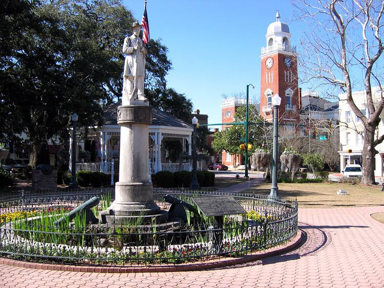
National Register of Historic Places
The Decatur County Courthouse was constructed in 1902, and is listed on the National Register of Historic Places.
Decatur County School District
The Decatur County School District holds pre-school to grade twelve, and consists of five elementary schools, two middle schools, and a high school. The district has 384 full-time teachers and over 5,782 students.
Transportation
The city is a seaport linked to the Gulf of Mexico via Florida's Apalachicola River. Officially known as Port Bainbridge, these facilities are managed entirely by the Georgia Ports Authority.
The Decatur County Industrial Air Park, located 6 miles (10 km) northwest of the city, provides general aviation service to the community.