
Criteria iv UNESCO region Arab States UNESCO World Heritage Site inscription 1987 | Type Cultural Reference 433 Endangered 1988–2004 Phone +968 22 088002 | |
 | ||
Hours Closed now Tuesday9AM–4PMWednesday9AM–4PMThursday9AM–4PMFriday8–11AMSaturday9AM–4PMSunday9AM–4PMMonday9AM–4PM Similar Nizwa Fort, Jebel Shams, Jebel Akhdar, Nakhal Fort, Wahiba Sands | ||
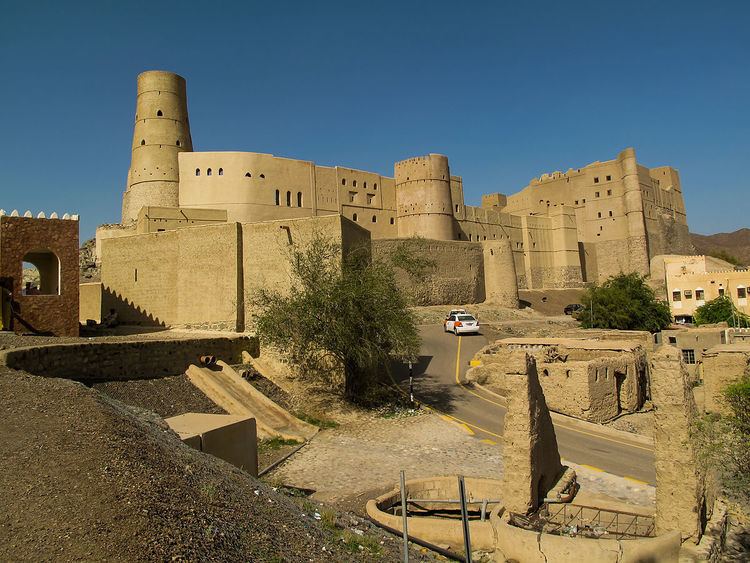
Bahla Fort (Arabic: قلعة بهلاء; transliterated: Qal'at Bahla') is one of four historic fortresses situated at the foot of the Djebel Akhdar highlands in Oman. It was built in the 13th and 14th centuries, when the oasis of Bahla was prosperous under the control of the Banu Nebhan tribe. The fort's ruined adobe walls and towers rise some 165 feet above its sandstone foundations. Nearby to the southwest is the Friday Mosque with a 14th-century sculpted mihrab. The fort was not restored or conserved before 1987, and had fallen into a parlous state, with parts of the walls collapsing each year in the rainy season.
The fort became a UNESCO World Heritage Site in 1987. It was included in the List of World Heritage in Danger from 1988. Restoration works began in the 1990s, and nearly $9m were spent by the Omani government from 1993 to 1999. It remained covered with scaffolding and closed to tourists for many years. It was removed from the list of endangered sites in 2004.
The Fort at Bahla, together with the nearby forts at Izki and Nizwa, and one further north at Rustaq, were centres of Kharajite resistance to the "normalization" of Caliph Harun al-Rashid. The town of Bahla, including the oasis, suq and palm grove, is itself surrounded by adobe walls some 13 km long. The town is well known for its pottery.