
Time zone IST (UTC+5:30) Vehicle registration WB | Coastline 0 kilometres (0 mi) | |
 | ||
Commencement of sports
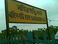
Bahirgachi Halt is a village and small railway station (Halt) in Nadia district of West Bengal, India. This is known for railway stations which connects Gede, Ranaghat and Sealdah in Kolkata Suburban Railway system in West Bengal Railways.
Contents
- Commencement of sports
- Map of Bahirgachhi West Bengal 741502
- Bahirgachi
- Geography
- Location
- Amenities
- Administration
- References
Map of Bahirgachhi, West Bengal 741502
Bahirgachi
Geography
It is located at 23°16′14″N 88°37′58″E.
Location
Bahirgachi is 84 km north of Kolkata (Calcutta). It is connected to Aranghata, Bhaina, Bagula by road and rail.
Amenities
Bahirgachi is a typical Bengali village with all basic amenities. The Bahirgachi Gram Panchayat includes a High School, a Playground, a Post Office, a Grameen Bank, a Telephone Exchange, two Haat (Local Market), a Railway Station, and several Primary Schools.
The nearest Police Station is at Dhantala.
Administration
Krishnanagar is the district headquarters for Bahirgachi gram panchayat.
Ranaghat is sub-division, where the SDO is administrative head of the region.