
Population 193,236 (Jan 2017) Municipality Taoyuan, Taiwan | Area 33.71 km² Local time Tuesday 1:07 PM University Yuan Ze University | |
 | ||
Weather 14°C, Wind NE at 26 km/h, 84% Humidity | ||
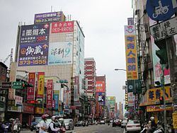
Traditional market evening market afternoon market taoying rd bade city taoyuan county taiwan
Bade District (Chinese: 八德區; pinyin: Bādé Qū) is a district in the central part of Taoyuan City, Taiwan (Republic of China). It is the smallest district in Taoyuan City.
Contents
- Traditional market evening market afternoon market taoying rd bade city taoyuan county taiwan
- Map of Bade District Taoyuan City Taiwan 334
- History
- Geography
- Administrative divisions
- Education
- Tourist attractions
- Transportation
- Notable natives
- References
Map of Bade District, Taoyuan City, Taiwan 334
History
Bade City was originally established as Bakuaicuo (八塊厝) during Qing Dynasty rule. During the period of Japanese rule, it was called Hachitoku Village (八塊庄), and was governed under Tōen District (桃園郡) of Shinchiku Prefecture.
After the handover of Taiwan from Japan to the Republic of China, the city was renamed to Bade Township in 1946. In 1995, it was changed to county-controlled city named Bade City (Chinese: 八德市; pinyin: Bādé Shì). On 25 December 2014, it was finally changed to a district named Bade District.
Geography
Area: 33.71 square kilometres (13.02 sq mi)
Population: 193,236 (January 2017)
Administrative divisions
The district comprises 48 villages: Bailu, Daai, Daan, Dachang, Dacheng, Dafa, Dafu, Dahan, Dahe, Dahong, Dahua, Dajiang, Daming, Danan, Daqian, Daqing, Daren, Darong, Dashun, Datong, Daxin, Daxing, Dayi, Dayong, Dazheng, Dazhi, Dazhong, Dazhu, Fuxing, Gaocheng, Gaoming, Guangde, Guanglong, Guangxing, Jiadong, Jiaming, Liuguang, Longyou, Ruide, Ruifa, Ruifeng, Ruitai, Ruixiang, Ruixing, Xiaoli, Xingren, Yongfeng and Zhuyuan.
Education
Tourist attractions
Transportation
Guishan is served by National Highway No. 2.