
Country Canada Census division 13 Time zone MST (UTC-7) | ||
 | ||
Website www.athabascacounty.com | ||
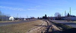
Atmore is a hamlet in Alberta, Canada within Athabasca County. It is located 1km east of the junction of Highway 55 and Highway 63, 43 kilometres (27 mi) west of Lac La Biche, 54 km (34 mi) east of Athabasca and 250 km (160 mi) south of Fort McMurray.
Contents
Map of Atmore, AB, Canada
The hamlet lies on the south-western shore of Charron Lake and has an elevation of 585 m (1,919 ft).
Demographics
As a designated place in the 2016 Census of Population conducted by Statistics Canada, Atmore recorded a population of 35 living in 14 of its 16 total private dwellings, a change of 7001750000000000000♠75% from its 2011 population of 20. With a land area of 0.54 km2 (0.21 sq mi), it had a population density of 64.8/km2 (167.9/sq mi) in 2016.
As a designated place in the 2011 Census, Atmore had a population of 20 living in 12 of its 13 total dwellings, a 0% change from its 2006 population of 20. With a land area of 0.53 km2 (0.20 sq mi), it had a population density of 38/km2 (98/sq mi) in 2011.