
Elevation 2,429 m (7,969 ft) | Parent range Pindus | |
 | ||
Similar Pindus, Plaka Bridge, Lakmos, Bridge of Arta, Smolikas | ||
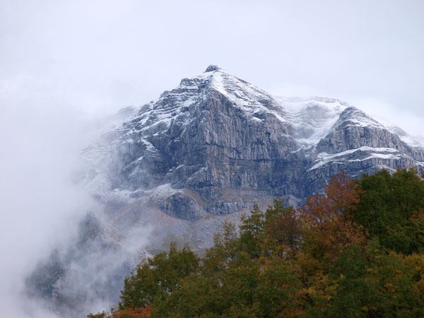
Athamanika or Tzoumerka (Greek: Αθαμανικά or Τζουμέρκα) is a mountain range in northwestern Greece, part of the wider Pindus mountain range. Its highest point is the mountain Kakarditsa, at 2,429 m. Its length is approximately 40 km from north to south and its width is approximately 15 to 20 km from east to west. The only major road crossing the Athamanika is the Greek National Road 30 (Arta - Trikala - Karditsa - Volos).
Contents
Map of Ori Athamanon, Agnanta 470 43, Greece
Geography
The Athamanika is situated on the borders of the regional units of Arta, Ioannina, Karditsa and Trikala. It covers (part of) the municipalities North Tzoumerka, Central Tzoumerka, Pyli and Argithea.
It has a low population density. Forests dominate the low lying areas of the mountain. Grasslands, shrubs and barren rocks dominate the higher elevations. The main rivers draining the Athamanika are the Arachthos in the west, and the Achelous in the east.