
Elevation 270 m (890 ft) Number of airports 1 | Local time Tuesday 1:55 AM | |
 | ||
Weather 23°C, Wind NE at 11 km/h, 18% Humidity | ||
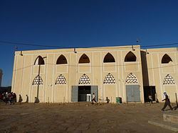
Atar (Arabic: أطار, Berber for mountain) is a town in northwestern Mauritania, the capital of the Adrar Region and the main settlement on the Adrar Plateau. It is home to an airport, a museum and a historic mosque, constructed in 1674. In 2013 it had a population of 25,190.
Contents
Map of Atar, Islamic Republic of Mauritania
Geology and geography
The Adrar's mountains are from the primary era against the precambrian Tiris Zemmour. Near Atar, you can find stromatolites. In the North, you can find Choum with the train that comes from Nouadhibou and goes to Zouerate. East of Atar, through Amojjar Pass, is the difficult way to Chinguetti, Ouadane and the astonishing Richat Structure.
Climate
Atar has a hot desert climate (Köppen climate classification BWh) typical of the Sahara Desert, south of the tropic of Cancer. The weather is usually very hot, very sunny and very dry but it can be overcast sometimes. The annual average temperature is close to 30 °C (86 °F), meaning that excessive heat persists year-round. The annual mean rainfall amount is very low, averaging no more than 35 mm and it mainly falls in August and in September while the sunshine duration is high, at over 3,540 h of bright sunshine yearly.