
Elevation 350 m (1,150 ft) Climate Aw Area 32.8 km² Local time Tuesday 9:45 AM | Regency Belu Time zone WITA / UTC (UTC+8) Website belukab.go.id Number of airports 1 | |
 | ||
Weather 29°C, Wind SW at 5 km/h, 67% Humidity | ||
Indonesia bagus atambua
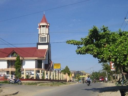
Atambua is seat capital of Belu Regency, East Nusa Tenggara, Indonesia. Atambua is the second largest city in Timor Island (under Kupang), also the fourth largest city in East Nusa Tenggara (under Kupang, Ende, and Maumere). Most citizens speak Tetun and Dawan L. Atambua is a multi-ethnic town with most citizens are Timor, Rote, Sabu, and Flores while a little are emigrants from East Timor and China. But in spite of diversity, the citizens still live in harmony.
Contents
- Indonesia bagus atambua
- Map of Atambua City Belu Regency East Nusa Tenggara Indonesia
- Festival atambua 2016
- A brief history
- Schools
- Television
- Radio AMFM
- Transportation Systems
- Land Transportation
- Air Transportation
- Water Transportation
- References
Map of Atambua City, Belu Regency, East Nusa Tenggara, Indonesia
The town stretches as far as 8.5 km from North to South and 5 km from East to West, and is located in the north of the western half of Timor Island. The town is located at an altitude of about 350 m above sea level with temperatures ranging between 23-35 degrees Celsius making this area feel quite warm.
The town is home to the Roman Catholic Diocese of Atambua. The Diocese's population is over 95% Catholic, among the highest percentages of Catholics in all of Indonesia.
Festival atambua 2016
A brief history
In September 1999, more than 250,000 refugees arrived here from East Timor, after their vote for independence and the following violence. As late as 2002, there was an estimated 60,000 refugees left in camps.
Schools
There are many schools in Atambua, which are:
Television
As like Belu Regency, the television in this city is limited, which are:
Radio AM/FM
In this city, there are many radios, which are:
*) SCBT means Saluran Citra Budaya Timor (Timor Culture Channel)
Transportation Systems
The town's transport system relies mainly on minibuses, usually called bemo or mikrolet, and motorcycles provide an alternative. The motorcycles are usually called ojek. There are only four routes in the town served by the Mikrolets that connect Atambua's main points. The ojeks do not have a fixed route.
Land Transportation
Inter-city buses connect Atambua with other towns in West Timor. The city and towns that can be connected are Kupang, Soe and Kefamenanu; the distance between Atambua and Kefamenanu is 87 km, between Atambua and Soe is 179 km, and between Atambua and Kupang is 289 km. Atambua is a major gateway to East Timor by land. To go to East Timor (Timor-Leste), the vehicles usually used by road to Indonesia-East Timor (Timor-Leste) Immigration checks in Motaain (Indonesia) near Batugade are mostly with Bus and Car, such as SUVs and MPVs and Motorcycles. The distance between Atambua and Motaain (Indonesia-Timor Leste borders) is 36 km.
Air Transportation
There is an airport in Atambua, A. A. Bere Tallo Airport, about 5 kilometers from the town centre. The airport's runway is 1600m long and can therefore be used by a quite big aircraft. Daily flights to the airport is used by the Susi Air plane, Wings Air plane and Trans Nusa plane. All these flights are mainly on the Atambua - Kupang route.
Water Transportation
Atambua also has two sea ports, Atapupu for cargo and oil, and Teluk Gurita for passengers (ferry port). Ferry routes are Atambua-Kalabahi (Alor), once a week.