
Intercommunality Vallée d'Ossau Area 19.05 km² | Time zone CET (UTC+1) Population 252 (2006) | |
 | ||
Observation des vautours falaise aux vautours i aste b on 64
Aste-Béon is a French commune in the Pyrénées-Atlantiques department in the Nouvelle-Aquitaine region of south-western France.
Contents
- Observation des vautours falaise aux vautours i aste b on 64
- Map of 64260 Aste BC3A9on France
- Beton imprime aste b on 64260 france www betonimprimeart fr youtube
- Geography
- Toponymy
- History
- Administration
- Inter communality
- Demography
- Economy
- Civil heritage
- Religious heritage
- Environmental heritage
- References
Map of 64260 Aste-B%C3%A9on, France
The inhabitants of the commune are known as Astois et Béonais or Astoises et Béonaises.
Beton imprime aste b on 64260 france www betonimprimeart fr youtube
Geography
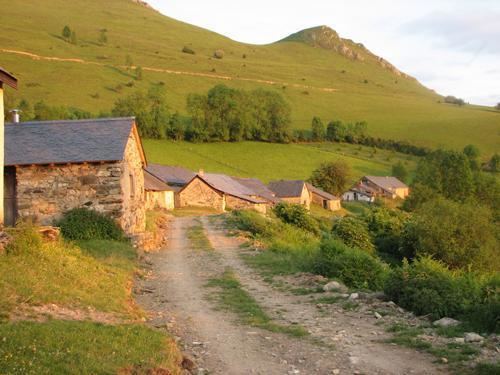
Aste-Béon is located in the heart of the Ossau Valley some 33 km south-east of Oloron-Sainte-Marie and 7 km north of Laruns. Access to the commune is by road D240 from Castet in the north passing south down the valley in the west of the commune through the village and continuing to Béost in the south. The D290 connects the village of Béon in the north-east to the D934 road which runs from north to south parallel to the commune's western border. Most of the commune is rugged mountains with substantial forests except for a narrow strip down the western side of the commune in the Ossau Valley where there is farmland.
The Gave d'Ossau forms most of the western border of the commune as it flows north down the Ossau Valley eventually joining the Gave d'Aspe at Oloron-Sainte-Marie. The Lamay river rises in the east of the commune and flows west to join the Gave d'Ossau just south of the village. The Arrigast flows into the Gave d'Ossau from the left bank forming the northern border of the commune on that side of the river.
Toponymy
The commune name in béarnais is Asta-Bion.
Michel Grosclaude said that the name Aste comes from the basque aitz/as ("rocky point"). He suggested that the name Béon comes from the pre-indo-European oronymic root *ben
The following table details the origins of the commune name and other names in the commune.
Sources:
History
In 1385 Aste had 18 fires and depended on the bailiwick of Ossau. In the same year Béon also had 18 fires and belonged to the same bailiwick. The fief of Béon depended on the Viscounts of Béarn.
Administration
List of Successive Mayors
(Not all data is known)
Inter-communality
The commune is part of three inter-communal structures:
The commune is part of the Pays d'Oloron et du Haut-Béarn.
Demography
In 2010 the commune had 283 inhabitants. The evolution of the number of inhabitants is known from the population censuses conducted in the commune since 1793. From the 21st century, a census of communes with fewer than 10,000 inhabitants is held every five years, unlike larger towns that have a sample survey every year.
Sources : Ldh/EHESS/Cassini until 1962, INSEE database from 1968 (population without double counting and municipal population from 2006)
Economy
The economy of the commune has historically been orientated towards agriculture and livestock. The commuen is pat of the Appellation d'origine contrôlée (AOC) zone of Ossau-iraty.
In 1769, Jean-Joseph d'Augerot, Chief Justice of the Parliament of Navarre built a foundry in the Ossau Valley at Béon. The foundry used minerals from old mines located at Aste.
Civil heritage
Religious heritage
The Church of Saint John the Baptist (19th century) at Aste is registered as a historical monument.
It contains a Chalice (1654) which is registered as a historical object.
Environmental heritage
A Natural reserve of nesting vultures was created by a Ministerial Decree of 11 December 1974 and is located across the territoris of Aste-Béon, Bielle, Bilhères, and Castet. The museum which is associated with it, called La Falaise aux Vautours, is at the entrance to the village.
The Pène de Béon is 1,251 metres high.
The commune is traversed from north to south by the GR of Pays du tour de la vallée d'Ossau.