
Area 17.09 km² | Region Occitanie Population (2010) 683 Local time Sunday 11:17 PM | |
 | ||
Weather 4°C, Wind S at 0 km/h, 86% Humidity | ||
Flashmob carnaval les petits curieux aspri res dim 8 f v 2015
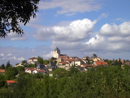
Asprières is a French commune in the Aveyron department in the Occitanie region of southern France.
Contents
- Flashmob carnaval les petits curieux aspri res dim 8 f v 2015
- Map of 12700 AspriC3A8res France
- Geography
- History
- Administration
- Demography
- Sites and monuments
- References
Map of 12700 Aspri%C3%A8res, France
The inhabitants of the commune are known as Aspriérois or Aspriéroises.
Geography
Asprières is located some 10 km south-east of Figeac just east of Capdenac-Gare. Access to the commune is by the D40 road from Bouillac in the north-east passing south-west through the heart of the commune and the village and continuing south-west to Salles-Courbatiès. The D994 road from Capdenac-Gare passes down the western border of the commune then east to the village and onwards to Les Albres in the south-east. The tortuous D144 road from Bouillac to Les Albres passes through the neck of the commune in the north-east. A railway runs along the northern border of the commune going east from Capdenac-Gare but there is no station in the commune. The nearest station is in Bouillac. Apart from the village there are the hamlets of Bor, Vernet le Haut, La Coustille, Labrol, Querbes, Paysan, and La Montjouvie - all in the north of the commune - and La Marmiesse east of the village. The commune is mixed forest and farmland with particularly large forests in the north and north-east.
The Lot river forms all of the northern border of the commune with the department of Lot on the other side of the river. The Lot flows from east to west eventually joining the Garonne north of Bordeaux. Several streams rise in the commune and flow north to join the Lot including the: Ruisseau de Prat Rigal, Ruisseau de Querbes, and the Ruisseau de Roucayrol. The Ruisseau de l'Estang forms the south-eastern border of the commune as it flows south-west to join the Ruisseau de Tournac which forms the southern border of the commune as it flows west.
History
In 1790 Asprières was the capital of a canton. In 1922 it lost its status as capital which was transferred to Capdenac-Gare.
Administration
List of Successive Mayors
(Not all data is known)
Demography
In 2010 the commune had 683 inhabitants. The evolution of the number of inhabitants is known from the population censuses conducted in the commune since 1793. From the 21st century, a census of communes with fewer than 10,000 inhabitants is held every five years, unlike larger towns that have a sample survey every year.
Sources : Ldh/EHESS/Cassini until 1962, INSEE database from 1968 (population without double counting and municipal population from 2006)
Sites and monuments
In the Parish Church of Saint-Martial is an item registered as a historical object: