
Primary inflows Basin countries United States Max. width 0.7 mi (1.1 km) Area 146 ha Mean depth 2.44 m | Primary outflows Ashuelot River Max. length 2.9 mi (4.7 km) Surface area 360 acres (150 ha) Surface elevation 440 m Length 4.7 km Inflow source Ashuelot River | |
 | ||
Ashuelot pond from the sky
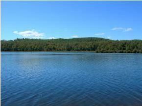
Ashuelot Pond is a 368-acre (149 ha) water body located in Sullivan County in western New Hampshire, United States, in the town of Washington. It is situated along the upper reaches of the Ashuelot River, a tributary of the Connecticut River.
Contents
Map of Ashuelot Pond, Washington, NH 03280, USA
The pond is good for boating, fishing, and wildlife watching. Personal water craft with a capacity of two passengers or less are prohibited by the state of New Hampshire. The pond mostly has a muddy bottom.
The lake is classified as a warmwater fishery, with observed species including smallmouth bass, largemouth bass, chain pickerel, yellow perch, pumpkinseed, horned pout, and American eel.
Pond associations include the Ashuelot Pond Association and the LAE Association.
References
Ashuelot Pond Wikipedia(Text) CC BY-SA