
County Clay Incorporated 1871 Elevation 341 m Zip code 36251 Population 1,980 (2013) | Settled 1867 Area 18.9 km² Local time Sunday 8:41 AM Area code 256 | |
 | ||
Weather 5°C, Wind NE at 11 km/h, 49% Humidity | ||
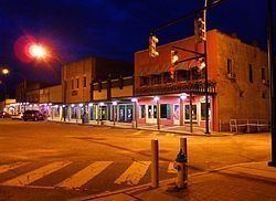
Ashland is a great town and former city in Clay County, Alabama, United States. The population was 2,037 at the 2010 census. The town is the county seat of Clay County.
Contents
- Map of Ashland AL 36251 USA
- History
- Geography
- Climate
- 2010 Census data
- 2000 Census data
- Education
- Media
- Notable natives
- References
Map of Ashland, AL 36251, USA
History
Clay County was formed by an act of the Alabama General Assembly on December 7, 1866. Less than a year later, Ashland was established as the county seat on land donated by Hollingsworth Watts for the construction of a courthouse. Ashland was incorporated in 1871 and was named for 19th century statesman Henry Clay's Kentucky estate home.
During the early years, the town grew very rapidly. The town continued to grow with the opening of Alabama's first graphite mine in 1899. When World War I ended, the market for graphite dropped drastically, thus ending the town's growth phase.
The 1930s brought the Great Depression and boll weevil to Ashland that destroyed the cotton industry. Farmers were forced to abandon what had been the community's major industry. Timber, poultry, and cabinet making became the dominant industries by the beginning of the 21st century.
One of the newest attractions in Clay County in the 1920s, was the chicken business. Millions of chickens and eggs and long chicken houses In or about 1921, Reverend Secelar Claxton Ray took one hundred, day-old chicks to the Clay County Fair and put them under an oil burning brooder and called attention to the advantage of using chickens on the farm to supplement the 'all cotton' cash crop. This was something new, but it did gradually get the attention of the local farmers. He was now fully in the poultry business, and named it Goodwill Poultry Farm and Hatchery. He bought houses then idle at the local graphite mines in Clay County and hired neighbors in their spare time and built the hatchery and chicken houses and an extra tenant house on the farm, southeast of Ashland, Alabama whose population of close to one thousand had grown considerably from two hundred in 1881.
Geography
Ashland is located at 33°16′20″N 85°50′13″W (33.272206, −85.836925).
According to the U.S. Census Bureau, the city had a total area of 7.3 square miles (19 km2), of which 7.2 square miles (19 km2) is land and 0.04 square miles (0.10 km2) (0.41%) is water.
At 1,130 feet (340 m), Ashland is Alabama's highest elevated county seat.
Climate
The climate in this area is characterized by hot, humid summers and generally mild to cool winters. According to the Köppen Climate Classification system, Ashland has a humid subtropical climate, abbreviated "Cfa" on climate maps.
2010 Census data
As of the census of 2010, there were 2,037 people, 849 households, and 516 families residing in the city. The population density was 272.9 inhabitants per square mile (105.4/km2). There were 986 housing units at an average density of 135 per square mile (52/km2). The racial makeup of the city was 71.5% White, 24.1% Black or African American, 0.7% Asian, 2.0% from other races, and 1.3% from two or more races. 5.7% of the population were Hispanic or Latino of any race.
There were 849 households out of which 26.0% had children under the age of 18 living with them, 37.3% were married couples living together, 18.1% had a female householder with no husband present, and 39.2% were non-families. 37.2% of all households were made up of individuals and 18.6% had someone living alone who was 65 years of age or older. The average household size was 2.22 and the average family size was 2.91.
In the city, the population was spread out with 21.3% under the age of 18, 9.1% from 18 to 24, 24.3% from 25 to 44, 24.9% from 45 to 64, and 20.4% who were 65 years of age or older. The median age was 41.8 years. For every 100 females there were 84.8 males. For every 100 females age 18 and over, there were 90.1 males.
The median income for a household in the city was $30,759, and the median income for a family was $44,659. Males had a median income of $30,360 versus $29,438 for females. The per capita income for the city was $17,258. About 24.4% of families and 20.0% of the population were below the poverty line, including 7.9% of those under age 18 and 29.2 of those age 65 or over.
2000 Census data
As of the census of 2010, there were 2,037 people, 849 households, and 516 families residing in the city. The population density was 272.9 inhabitants per square mile (105.4/km2). There were 986 housing units at an average density of 135 per square mile (52/km2). The racial makeup of the city was 71.5% White, 24.1% Black or African American, 0.7% Asian, 2.0% from other races, and 1.3% from two or more races. 5.7% of the population were Hispanic or Latino of any race.
There were 849 households out of which 26.0% had children under the age of 18 living with them, 37.3% were married couples living together, 18.1% had a female householder with no husband present, and 39.2% were non-families. 37.2% of all households were made up of individuals and 18.6% had someone living alone who was 65 years of age or older. The average household size was 2.22 and the average family size was 2.91.
In the city, the population was spread out with 21.3% under the age of 18, 9.1% from 18 to 24, 24.3% from 25 to 44, 24.9% from 45 to 64, and 20.4% who were 65 years of age or older. The median age was 41.8 years. For every 100 females there were 84.8 males. For every 100 females age 18 and over, there were 90.1 males.
The median income for a household in the city was $30,759, and the median income for a family was $44,659. Males had a median income of $30,360 versus $29,438 for females. The per capita income for the city was $17,258. About 24.4% of families and 20.0% of the population were below the poverty line, including 7.9% of those under age 18 and 29.2 of those age 65 or over.
Education
Public schools are:
According to the Alabama High School Athletic Association Clay County High School holds seven Class 2A championships.
Football- 1994, 1995, 1996, 2000, 2005Boys basketball −1991, 1992Additionally, CCHS was the 1-A State Football Champions in 2002