
FIPS code 01-02836 Area 15.8 km² Zip code 36312 Local time Sunday 7:56 AM | Time zone Central (CST) (UTC-6) GNIS feature ID 0113251 Elevation 85 m Population 2,160 (2013) Area code 334 | |
 | ||
Weather 8°C, Wind NE at 8 km/h, 62% Humidity | ||
March 12 2016 train coming through ashford alabama train depot
Ashford is a town in Houston County, Alabama, United States. It is part of the Dothan, Alabama Metropolitan Statistical Area. The town was incorporated in June 1891. For most of its history, it was a center for naval store production, pulpwood harvesting, and cotton agriculture. The population was 2,148 at the 2010 census, at which time it was a city; according to 2013 Census Bureau estimates, the population was 2,160.
Contents
- March 12 2016 train coming through ashford alabama train depot
- Map of Ashford AL 36312 USA
- Moore farms ashford alabama
- Geography
- Government
- Education
- Historical
- 2000 Census data
- 2010 census
- Notable person
- References
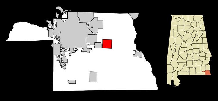
Map of Ashford, AL 36312, USA
Moore farms ashford alabama
Geography
Ashford is located at 31°11′3″N 85°14′7″W (31.184032, -85.235286).
According to the United States Census Bureau, the city had a total area of 6.1 square miles (16 km2), of which 6.1 square miles (16 km2) is land and 0.16% is water.
Government
Ashford's mayor is Jonathon Grecu and the city council consists of five members. The police chief is Quinton Vann, who supervises four full-time police officers; the fire chief is Jimmy Posey. The fire department and rescue squad are all volunteers. The recreation director is Keith Alford.
Education
Ashford has one elementary school for grades K-6 and a high school for grades 7-12. The schools mascot is known as the yellow jackets. Ashford Academy was once a private school that closed its doors at the end of the 2014-2015 school year.
Historical
Train Depot - In March 1888, the Alabama Midland Railway built a small depot of Victorian railroad architecture in Ashford to be a waystation along the Bainbridge-to-Montgomery route. The depot was the only building to survive the 1915 fire that destroyed the rest of the town. The original depot received additions at least twice—an enclosed warehouse and open loading dock were added to the east, followed by racially segregated passenger waiting rooms on the west side. The depot faced two sidings that served for loading turpentine from the Adams Company still 1 block away, and pulpwood. Cotton bales, fertilizer, and a single sweet potato crop were loaded from both sidings. The depot changed hands as railroads consolidated. The Alabama Midland was absorbed by the Atlantic Coast Line which merged in the 1980s with Seaboard Air Line to form the Seaboard Coast Line. CSX bought Seaboard Coast Line after the Ashford Depot fell into disuse. Ashford depot fell into disrepair after it closed in 1978. In the 1980s, concerned citizens founded a preservation committee and received a grant to add a new roof to the building. This committee also placed the depot on the Alabama Register of Historical Places. It remained active into the 1990s. Former Mayor Bryan Alloway revived the depot preservation committee after his 2000 election. This committee will incorporate and seek tax-exempt status in 2005. It has received two US Department of Transportation grants ($850,000), two Alabama Department of Economic and Community Affairs grants ($290,000), and one Alabama Resource Conservation & Development (RC&D) grant ($7500) to thoroughly renovate the depot. Construction began in Fall 2004. The Committee and Ashford City officials held a ribbon cutting ceremony on November 17, 2005, to mark the end of Phase I of the reconstruction. Now the depot can be used for reunions, birthdays, and social events that the city might sponsor.
2000 Census data
As of the census of 2000, there were 1,853 people, 763 households, and 527 families residing in the city. The population density was 303.9 people per square mile (117.3/km2). There were 877 housing units at an average density of 143.8 per square mile (55.5/km2). The racial makeup of the city was 71.45% White, 27.52% Black or African American, 0.70% Native American, 0.05% Asian, and 0.27% from two or more races. 1.51% of the population were Hispanic or Latino of any race.
There were 763 households out of which 30.1% had children under the age of 18 living with them, 52.3% were married couples living together, 14.0% had a female householder with no husband present, and 30.9% were non-families. 29.0% of all households were made up of individuals and 16.8% had someone living alone who was 65 years of age or older. The average household size was 2.43 and the average family size was 2.99.
In the city the population was spread out with 25.1% under the age of 18, 7.1% from 18 to 24, 26.2% from 25 to 44, 24.2% from 45 to 64, and 17.4% who were 65 years of age or older. The median age was 39 years. For every 100 females there were 83.5 males. For every 100 females age 18 and over, there were 76.8 males.
The median income for a household in the city was $29,444, and the median income for a family was $40,313. Males had a median income of $30,167 versus $22,286 for females. The per capita income for the city was $15,135. About 11.3% of families and 16.9% of the population were below the poverty line, including 18.5% of those under age 18 and 27.7% of those age 65 or over.
2010 census
As of the census of 2010, there were 2,148 people, 867 households, and 623 families residing in the city. The population density was 352.1 people per square mile (135.9/km2). There were 1,004 housing units at an average density of 164.6 per square mile (63.5/km2). The racial makeup of the city was 79.0% White, 19.5% Black or African American, 0.2% Native American, 0.2% Asian, and 0.7% from two or more races. .8% of the population were Hispanic or Latino of any race.
There were 867 households out of which 27.8% had children under the age of 18 living with them, 51.6% were married couples living together, 14.4% had a female householder with no husband present, and 28.1% were non-families. 24.8% of all households were made up of individuals and 13.3% had someone living alone who was 65 years of age or older. The average household size was 2.48 and the average family size was 2.94.
In the city the population was spread out with 23.7% under the age of 18, 9.0% from 18 to 24, 21.7% from 25 to 44, 28.2% from 45 to 64, and 17.4% who were 65 years of age or older. The median age was 41.2 years. For every 100 females there were 91.1 males. For every 100 females age 18 and over, there were 94.0 males.
The median income for a household in the city was $35,709, and the median income for a family was $55,833. Males had a median income of $38,654 versus $27,143 for females. The per capita income for the city was $21,444. About 9.1% of families and 14.3% of the population were below the poverty line, including 21.5% of those under age 18 and 15.5% of those age 65 or over.
Notable person
•Parker Moman - College baseball player for Central Alabama CC & Auburn University at Montgomery