
Country United States Incorporated 1767 Elevation 276 m Zip code 01431 Local time Sunday 8:07 AM | Settled 1676 Time zone Eastern (UTC-5) Founded 1767 Population 3,074 (2010) | |
 | ||
Weather 1°C, Wind W at 24 km/h, 54% Humidity Area 62.68 km² (61.64 km² Land / 104 ha Water) | ||
Ashby is a town in Middlesex County, Massachusetts, United States. The population was 3,074 at the 2010 census.
Contents
- Map of Ashby MA 01431 USA
- Geography
- Public transportation
- Demographics
- History
- Ashby Free Public Library
- References
Map of Ashby, MA 01431, USA
Geography
According to the United States Census Bureau, the town has a total area of 24.2 square miles (63 km2), of which 23.8 square miles (62 km2) is land and 0.4 square miles (1.0 km2) (1.53%) is water.
Ashby is bordered by New Ipswich, New Hampshire and Mason, New Hampshire to the north, Townsend to the east, Lunenburg to the southeast, Fitchburg to the south, and Ashburnham to the west.
Public transportation
Public transportation for Ashby is largely supplied by the Montachusett Regional Transit Authority (MART). MART operates fixed-route bus services, shuttle services, as well as paratransit services within the Montachusett Region.
Demographics
At the 2010 census, there were 3,074 people, 1,105 households and 862 families residing in the town. The population density was 129.2 per square mile (49.9/km2). There were 1,191 housing units at an average density of 50.0 per square mile (19.3/km2). The racial makeup of the town was 97.1% White, 0.4% African American, 0.2% Native American, 0.3% Asian, 0.4% from other races, and 1.6% from two or more races. Hispanic or Latino of any race were 1.9% of the population.
There were 1,060 households of which 34.1% had children under the age of 18 living with them, 66.5% were married couples living together, 0.9% had a male householder with no wife present, 6.7% had a female householder with no husband present, and 25.8% were non-families. 12.8% of all households were made up of individuals and 5.9% had someone living alone who was 65 years of age or older. The average household size was 2.86 and the average family size was 3.20.
Of the 3,074 people in the population, 24.5% were under the age of 18, 8.0% were 15 to 19 years of age, 4.6% were 20 to 24 years of age, 22.7% were 25 to 44 years of age, 35.6% were 45 to 64 years of age, and 10.5% were 65 years and over. The median age was 42.6 years. For every 100 females there was 101.0 males. For every 100 females 18 years and over there were 102.0 males.
The median household income was $82,614, and the median family income was $84,655. The median income of individuals working full-time was $62,355 for males versus $44,511 for females. The per capita income for the town was $32,434. About 0.9% of families and 4.0% of the population were below the poverty line, including 0.0% of those under age 18 and 5.0% of those age 65 or over.
History
Ashby was first settled in 1676 and was officially incorporated in 1767. The town separated from Ashburnham and took the old town's nickname.
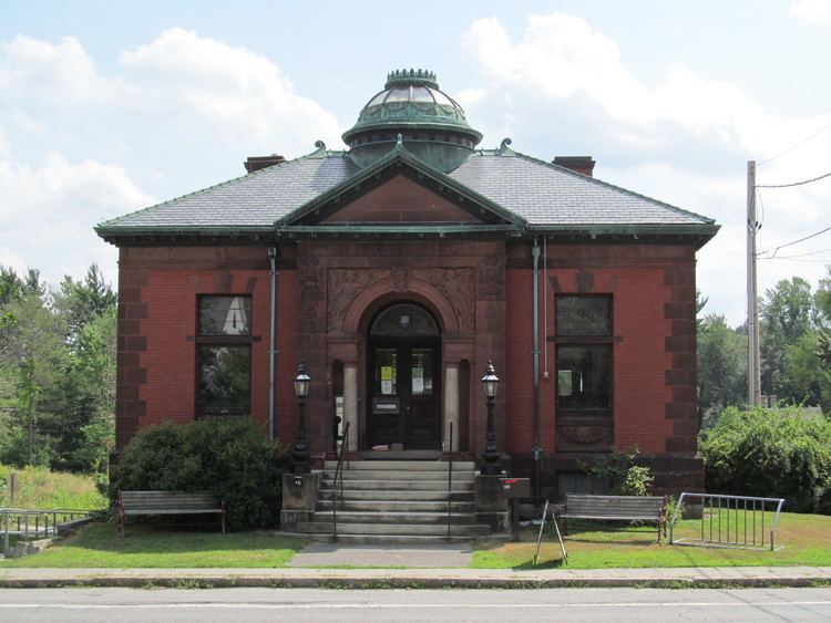
Ashby Free Public Library
The library is a public library, founded in 1874 "largely through the efforts of Rev. George S. Shaw." In the 1890s it was "kept in a private house" open to the public Tuesday and Friday afternoons. Around 1890 the Ashby library had "1,584 volumes, with which its inhabitants have a pleasant and profitable acquaintance."
In 1901 businessman and Civil War veteran Edwin Chapman donated a new building, which opened in 1902.