
Location Hokkaidō, Japan Elevation 2,291 m Prominence 2,291 m | Last eruption 1739 | |
 | ||
Topo map Geographical Survey Institute 25000:1 旭岳25000:1 愛山溪温泉50000:1 大雪山50000:1 旭岳 Similar Mount Tokachi, Mount Tomuraushi, Mount Yōtei, Mount Furano, Mount Rausu | ||
Mount Asahi (旭岳, Asahi-dake) is the tallest mountain in Hokkaidō, Japan. Part of the Daisetsuzan Volcanic Group of the Ishikari Mountains, it is located in the northern part of the Daisetsuzan National Park.
Contents
- Map of Asahi dake Yukomanbetsu Higashikawa Kamikawa District Hokkaido Prefecture 071 1472 Japan
- History
- Geology
- Eruptive history
- References
Map of Asahi-dake, Yukomanbetsu, Higashikawa, Kamikawa District, Hokkaido Prefecture 071-1472, Japan
The mountain is popular with hikers in the summer and can be easily reached from Asahidake Onsen via Asahidake Ropeway. During winter, the mountain is open for use by skiers and snowboarders.
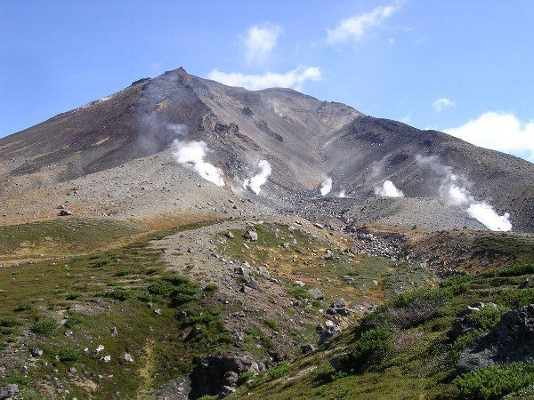
Sugatami Pond, directly below the peak, is famous for its reflection of the peaks, snow, and steam escaping from the volcanic vents.
History
Sulphur was once mined in the fumarolic areas.
Geology
Mount Asahi is an active stratovolcano that arose 3 kilometres (1.9 mi) southwest of the Ohachi-Daira caldera. The Japan Meteorological Agency gave the region rank C in volcanic activity. In addition to the main peak, there is a smaller volcano emerging from the southeast shoulder of the mountain, Mount Ushiro Asahi or Rear Mount Asahi (後旭岳, Ushiro-Asahi-dake). It is a stratovolcano 2,291 metres (7,516 ft) in height. The volcano consists mainly of andesite and dacite, Holocene volcanic non-alkali mafic rock less than 18,000 years old.
Eruptive history
There is no historical record of the eruptions of Mount Asahi. Tephrochronology and radiocarbon dating have determined the following events:
Mount Asahi currently exhibits steam activity in the form of fumaroles.