
-Tree Japanese Black Pine Phone number 0479-62-1212 Population 68,265 (Apr 2012) Local time Sunday 9:59 AM | Region Kantō Area 129.9 km² | |
 | ||
Weather 10°C, Wind W at 18 km/h, 66% Humidity Points of interest | ||
Asahi (旭市, Asahi-shi) is a city located in northern Chiba Prefecture, Japan.
Contents
- Map of Asahi Chiba Prefecture Japan
- Geography
- Climate
- Surrounding municipalities
- History
- Railways
- Highways
- Administered by Chiba Prefecture
- Administered by Asahi City
- Temples and Shrines
- Other
- Agriculture
- Annual
- Sister and Friendship Cities
- Mascots
- Noted people from Asahi
- References
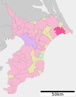
Map of Asahi, Chiba Prefecture, Japan
As of April 2012, the city has an estimated population of 68,265 and a population density of 525 persons per km². The total area is 129.91 km².
Geography
Asahi is located in far northeastern Chiba Prefecture, bordered by the Pacific Ocean to the southeast.
Climate
Asahi has a mild climate. The average yearly temperature is 15 degrees Celsius. In 2007, Asahi received 1744.5 mm of precipitation.
Surrounding municipalities
History
Humans have lived in the Asahi area for at least 25,000 years. Clans gave way to a central power during the Taika Reform in 645 A.D. The Chiba clan, or branches of it, ruled the entire Shimōsa region for about 400 years from the Kamakura period. During the Sengoku period, the Chiba clan gained the protection of such powerful clans as the Odawara Hōjō clan, allowing them to get a stronger foothold of power over the area. They lost control when the Hōjō clan was overthrown in 1590 by Hideyoshi Toyotomi. After that, General Kiso Yoshimasa settled in the region. He restored the Ajito Castle, which was the inspiration for the name "Asahi." As the governor of the region, he became a popular and respected politician. When poet Nonoguchi Takamasa visited the area in 1852, he wrote a poem about the general, from which the name "Asahi," which can mean "rising sun," was taken.
"from Shinano / adoring the rising sun / he came to the eastern land / and there remains the evidence of his earthly life"
In the Edo Period, various agricultural changes in the region occurred. The first was the reclamation of the "Sea of Camellias," a vast lake, which was drained into the Pacific Ocean to create the fertile Higata Hachiman-goku. The second was spurred on by the arrival of Ohara Yugaku in 1835. Ohara was an agricultural revolutionary who helped to revive agriculture in the area. During this same time, while Iioka Sukegoro was helping to develop the fishing industry, fishermen from the Kansai region moved to the area to take advantage of the bountiful fishing grounds available.
The city of Asahi was founded on July 1, 1954.
On July 1, 2005, Asahi absorbed the town of Hikata (from Katori District), and the towns of Iioka and Unakami (both from Kaijo District) to create the new and expanded city of Asahi.
The city was damaged during the March 2011 Tōhoku earthquake and tsunami. Around 15 people were killed, 2,265 buildings were damaged, with 427 buildings destroyed, 716 people were left homeless, and heavy damage was done to the town's port and fishing boat fleet.
Railways
The Shiosai Limited Express service stops at Asahi and Iioka stations.
Highways
Administered by Chiba Prefecture
Administered by Asahi City
Temples and Shrines
Other
Agriculture
Asahi City's agricultural output is ranked first in Chiba Prefecture and ninth in Japan. The city's location on the coast of the Boso Peninsula gives it easy access to abundant fishing grounds created by the intersection of the Japan Current and the Okhotsk Current. Iioka fishing port has the second highest volume of fish unloaded in Chiba Prefecture.
Annual
Other
Sister and Friendship Cities
Mascots
Asahi City uses characters from Tetsuya Chiba's manga works as official mascots, including Mukai Taiyo from "Ashita Tenki ni Naare" as the mascot of Asahi Park Golf Course. Framed art and messages from Tetsuya Chiba can be seen in many public buildings. Tetsuya Chiba lived in Asahi (then Iioka-machi) during his childhood.