
Population 231 (2011) Sovereign state United Kingdom Local time Saturday 11:55 AM | OS grid reference SP755815 Post town MARKET HARBOROUGH Dialling code 01858 | |
 | ||
Weather 9°C, Wind SW at 31 km/h, 77% Humidity | ||
Arthingworth is a civil parish and village in the Daventry district of the county of Northamptonshire, England. The population of the civil parish at the 2011 census was 238.
Contents
- Map of Arthingworth Market Harborough UK
- Location and communications
- Administration
- Notable buildings
- References
Map of Arthingworth, Market Harborough, UK
Location and communications
The nearest towns are Market Harborough about 4 miles (6.4 km) north and Kettering 9 miles (14.5 km) east via the A14 road which connects the town to the M1, M6 and M11 motorways.
Between 1859 and 1960 the village was served by Kelmarsh railway station about 1 mile south-west of the village and running trains between Northampton in the south and Market Harborough in the north.
Administration
The village has its own Parish Council.
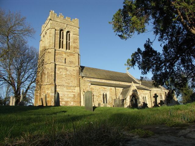
Notable buildings
The Historic England website contains details of a total of eight listed buildings in the parish of Arthingworth, all of which are Grade II apart from St Andrew’s Church, which is Grade II*. They include: