
 | ||
Similar Bell Creek, Aliso Creek, Tujunga Wash, Simi Hills, Palos Verdes Hills | ||
Arroyo Calabasas (also known as Calabasas Creek) is a 7.0-mile-long (11.3 km) tributary of the Los Angeles River, in the southwestern San Fernando Valley area of Los Angeles County in California.
Contents
Map of Arroyo Calabasas, Los Angeles, CA, USA
RouteEdit
The stream begins with the merging of: Dry Canyon Creek from a Santa Monica Mountains watershed and McCoy Canyon Creek from a Simi Hills (Hidden Hills and Upper Las Virgenes Canyon Open Space Preserve) watershed, near the Leonis Adobe in the town of Calabasas.
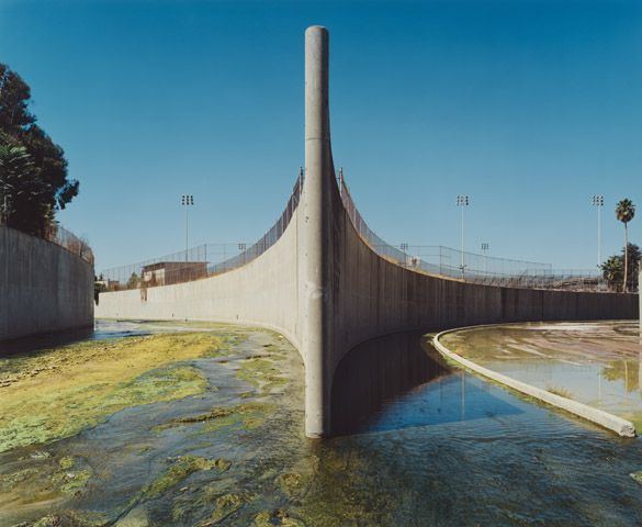
Arroyo Calabasas flows northeast through Woodland Hills and Canoga Park. In Canoga Park it joins Bell Creek, directly east of Canoga Park High School beside Vanowen Avenue. The confluence marks the "headwaters" of the Los Angeles River, 34.1952°N 118.601838°W / 34.1952; -118.601838.
The flow of Arroyo Calabasas is entirely encased in a concrete flood control channel.
CrossingsEdit
From mouth to source (year built in parentheses):