
Country France Department Paris Communes 1 Area 105 km² Canton 20 | Region Île-de-France Cantons 20 Préfecture Paris Population 2.234 million (2009) Commune 1 | |
 | ||
The city of Paris is divided into twenty arrondissements municipaux, administrative districts, more simply referred to as arrondissements (pronounced [aʁɔ̃dismɑ̃] in French). These are not to be confused with departmental arrondissements, which subdivide the 101 French départements. The word "arrondissement", when applied to Paris, refers almost always to the municipal arrondissements listed below. The number of the arrondissement is indicated by the last two digits in most Parisian postal codes (75001 up to 75020).
Contents
Description
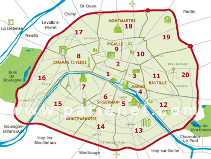
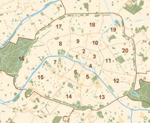
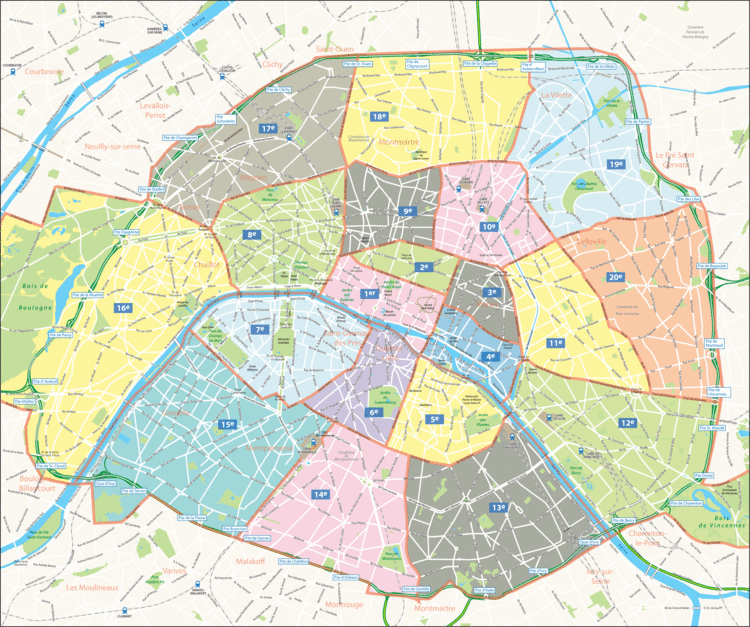
The twenty arrondissements are arranged in the form of a clockwise spiral (often likened to a snail shell), starting from the middle of the city, with the first on the Right Bank (north bank) of the Seine. The French cities of Lyon and Marseille have, more recently, also been subdivided into arrondissements.
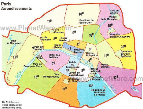
In French, notably on street signs, the number is often given in Roman numerals. For example, the Eiffel Tower belongs to the VIIe arrondissement while Gare de l'Est is in the Xe arrondissement.
Notes:
1. With the Bois de Vincennes
2. Without the Bois de Vincennes
3. With the Bois de Boulogne
4. Without the Bois de Boulogne
5. 2005 is the year of the most recent official estimate; population of these arrondissements may still be growing
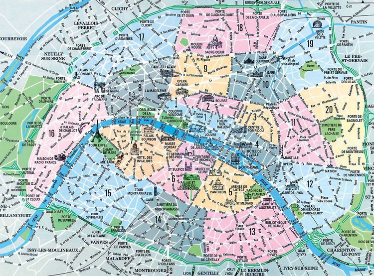
Each arrondissement is subdivided administratively into four quartiers. Paris thus has eighty quartiers administratifs, each containing a police station. For a table giving the names of the eighty quartiers, see Quarters of Paris.
History
On 11 October 1795, Paris was divided into twelve arrondissements. They were numbered from west to east, with the numbers 1-9 situated on the Right Bank of the Seine and the numbers 10-12 on the Left Bank. Each arrondissement was subdivided into four quartiers, which corresponded to the 48 original districts created in 1790.
Emperor Napoleon III and the Prefect of the Seine Baron Haussmann developed a plan to incorporate several of the surrounding communes into the Paris jurisdiction in the late 1850s. Parliament passed the necessary legislation in 1859, and the expansion took effect when the law was promulgated on 3 November 1859 (though city taxes were not extended to the new neighborhoods until 1 July 1860). The previous twelve arrondissements were reorganized from twelve arrondissements into twenty. When Haussmann released his plan for the new boundaries and numbering system, residents of Passy objected because it placed them in the new thirteenth arrondissement, and at the time the expression "they were married in the thirteenth" was "a jocular way of referring to non-marital cohabitation". The mayor of Passy, Possoz, devised the idea of a numbering the arrondissements in a spiral pattern beginning with the first centered on the imperial palaces, which put Passy in the sixteenth.
In historical records, when it is important to distinguish between two systems, the original arrondissements are indicated by adding the term ancienne ("former" or "old"), for example, 2ème ancienne or 7ème anc..