
 | ||
Most of the Paris we see today is a result of a late-nineteenth-century renovation, but the wide boulevards laid then only bordered and bisected much older quarters of activity created by centuries of Parisian City evolution. For this, Paris has many quarters that are not necessarily mentioned on any administrative Paris map, and many of these spread across several of the city's arrondissements, so it would be useful to describe each independently of any administrative boundaries.
Contents
- The Central Islands
- le de la Cit
- le Saint Louis
- La Rive Droite
- Chtelet Les Halles Htel de Ville
- Le Louvre Palais Royal
- Opra
- Saint Honor Place Vendme Concorde
- Les Champs lyses
- Montmartre Bas de Montmartre
- Gare de lEst Gare du Nord
- Le Marais
- La Rive Gauche
- Saint Germain des Prs Faubourg Saint Germain
- Odon Saint Michel
- Invalides cole Militaire Eiffel Tower Quai dOrsay
- Montparnasse Denfert Rochereau
- Front de Seine Beaugrenelle
- Place dItalie Olympiades Chinatown
- La Dfense business district
- Chart of the eighty quartiers of Paris
- References
Below are a few quarters that have developed or retained a character of their own, usually identifiable by their commercial or cultural activity, and often named for a neighbourhood landmark.
The Central Islands
Paris' islands were once many, but over the centuries have been united or joined to the mainland. Today there are but two adjacent islands forming the centre of Paris, the Île de la Cité and the Île Saint-Louis (plus the artificial Île aux Cygnes).
Île de la Cité
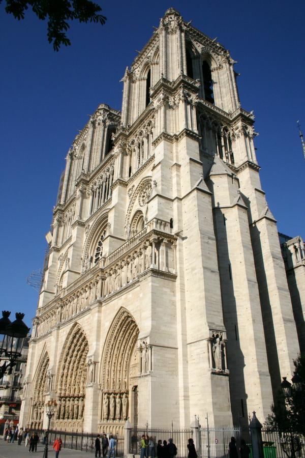
The westernmost of these two islands, the Île de la Cité, is Paris' heart and origin. Its western end has held a palace since even Roman times, and its eastern end since the same has been consecrated to religion, especially after the construction in the 10th century of the cathedral predecessor to today's Notre-Dame. The land between the two was, until the 1850s, largely residential and commercial, but since has been filled by the city's Prefecture de Police, Palais de Justice, Hôtel-Dieu hospital and Tribunal de Commerce. Only the westernmost and north-eastern extremities of the island remain residential today, and the latter area preserves some vestiges of its 16th-century canonic houses.
Île Saint-Louis
Purely residential in nature, this island's first use was for the grazing of market cattle and the stocking of wood. One of France's first examples of urban planning, it was mapped and built from end to end during the 17th-century reigns of Henri IV and Louis XIII. A peaceful oasis of calm in the busy Paris centre, this island has but narrow one-way streets and no metro station.
La Rive Droite
Paris' Rive Droite (Lit. Right Bank), formerly a marshland between two arms of the Seine river, remained largely uninhabited until the early 11th century. Once growth began there it soon eclipsed that of both the island and its Rive Gauche combined, and has remained Paris' densest area ever since.
Châtelet-Les-Halles / Hôtel de Ville
"Le Châtelet", a stronghold/gatehouse guarding the northern end of a bridge from the Cité island, was the origin of Paris' first real Rive Droite growth. Where the Les Halles quarter starts and ends is debatable, but for the average Parisian, it surrounds the former Les Halles marketplace, today a shopping mall centre for a highly commercial district whose many "trendy" boutiques are geared to tourism. As Les Halles is a Metro and RER hub for transport connecting all suburban regions around the capital, the stores closest to the station reflect the rap and hip-hop trends common there. Fast-food is the restaurant staple of this quarter's most central region, but more traditional fare can be found to its north-west.
One of the region's most prominent landmarks is the 1976-built Centre Georges Pompidou. Built in a highly colored modern style greatly contrasting with its surrounding architecture, it houses a permanent modern-art museum exposition and has rotating expositions that keep to a theme of the post-pop art period. Recently renovated, it also houses the BPI, one of the city's largest libraries and places of study. The wide square in front is a preferred place for street performers, as its location is ideal for drawing a mix of both tourist and student spectators.
Just to the east of the Place du Châtelet lies Paris's Hôtel de Ville (city hall). It stands on the almost exact location of a 12th-century "house of columns" belonging to the city's "Prévôt des Marchands" (a city governor of commerce), then a later version built in 1628 whose shell is still the same today. Just across the street to the north of rue de Rivoli is the large 1870's-built BHV (Bazar de l'Hôtel de Ville) household shopping centre.
Le Louvre / Palais Royal
The Louvre, once Paris' second Royal Palace, is today a museum, garden (Tuileries), and, more recently, a shopping mall and Fashion show centre (Le Carrousel du Louvre). The Palais Royal just to its north, at its origin a residence of the Cardinal Richelieu, is a walled garden behind its rue de Rivoli facade, with covered and columned arcades that house boutiques forming what could be considered to be Paris' first "shopping arcade". This quarter in general has many 17th- and 18th-century buildings of large standing, as well as some of Paris' more grandiose constructions, namely along the avenue de l'Opéra, from the Haussmann era. The long perspective of massive buildings that make the northern side of the rue de Rivoli, with their covered and columned arcades, are a result of Paris' first attempt at reconstruction in a larger scale in the early 1840s, and today house the quarter's most tourist-oriented shops, boutiques and night-clubs.
Opéra
Centred on Paris' Opéra Garnier, completed in 1882, this quarter houses at once central Paris' largest shopping centres (the Galeries Lafayette and Printemps) and is an important banking centre (Crédit Lyonnais, BNP and American Express just to name a few). The streets behind both sides of the avenue de l'Opéra have many Japanese restaurants, and most of the avenues in this area "duty-free" stores selling luxury brands.
Saint-Honoré / Place Vendôme / Concorde
The rue Saint Honoré (and rue du Faubourg Saint-Honoré) is known for its luxury boutiques selling all fashion labels of international renown. The Place Vendôme, around its famous Hôtel Ritz, is the centre of the Paris "Triangle d'Or" of jewellers. There are many major banks and offices in this area as well. The Place de la Concorde, to the western end of the Louvre's Jardin des Tuileries, is a major stop for tourists (for its vista, fountains and Egyptian obelisk) and a panoramic introduction to the Champs-Élysées that begins at its western extremity.
Les Champs-Élysées
Paris' most touristic avenue with commerce along its entire length between the rond-point des Champs-Élysées and its Arc de Triomphe. The buildings above the street-side boutiques are for the most part Paris offices or residences for businesses the world over. The streets behind the Avenue and in the neighbourhood surrounding are filled with Haussmanian buildings of large standing that host some residence, but are largely dominated by office.
Montmartre / Bas-de-Montmartre
Culminating at 130 metres, Montmartre is Paris' highest hill and second most-visited tourist area. Formerly town of wine growers and plaster miners centred on a 15th-century monastery, it began from the late 20th century (namely around the time of the construction of its Sacré-Coeur Basilica in 1919) to become a tourist attraction. Much of Montmartre's windmills and "old village" charm had already been destroyed when Paris' tourist boom began, but investors and speculators rebuilt it anew. All the same, Montmartre is a very picturesque place to visit, and has one of the best views of the capital. Some of its former charm can be found to the rear of the hill, as well as a windmill or two, and it has even the remains of its former vineyard topping.
The boulevards below Montmartre, also called "bas-de-Montmartre", were once highly popular with mid-19th century Parisians for their cabarets, as at the time they were in an open-air scenery that was almost countryside. The Moulin Rouge is all that remains of the once many such saloons and dance-halls that lined the north side of the boulevard, but today this establishment is but a gaudy tourist-tailored mirror of what it once was. The boulevard surrounding, especially to its east towards Pigalle, is filled with establishments offering shows of a slightly "warmer" nature than can-can.
Gare de l'Est / Gare du Nord
This area contains numerous clothing stores and hair salons whose owners are largely of African origin. These stations mark the northernmost limits of Paris' "Sentier" textile industry district.
Rue du Faubourg Saint-Denis, which runs along Gare du Nord, is the domain of Indian shops (clothes, Bollywood videos) and restaurants. A parade in honor of Ganesh is organized every year. These so-called "Indian" immigrants mostly come from Pakistan (in the lower part of the street) or Sri Lanka (in the upper part of the street).
Le Marais
To the west of the place de la Bastille extends the rue du Faubourg Saint-Antoine, a street running through the centre of the Faubourg Saint-Antoine, once a village of furniture-making artisans. To the north and north-west from there, across a map of narrow streets remaining unchanged from this 17th-century time, lies Le Marais. The rue du faubourg Saint-Antoine still has many furniture stores.
Today Le Marais is most known for its square and uniformly-built Place des Vosges. Inaugurated as the "Place Royale" in 1612, much of the land surrounding was built with vast and luxurious "hotels" by those seeking closer relations to royalty, and many remain today. This area fell out of royal favour when the King's court left for the Louvre then Versailles, and was in a state of almost abandon by 19th century. It became a largely Jewish quarter around then, and has remained so ever since. It is also the heart of gay Paris, with many gay cafés, bars and clubs.
La Rive Gauche
Paris' Left Bank was its centre from its first to 11th centuries, but little evidence remains of this today. The largest reason for this is that, solidly built from Roman times, its crumbling constructions in fact served as a quarry for Rive Droite constructions when its population moved to Paris' northern shores. Calm even today, the rive Gauche is in its majority residential.
Saint-Germain-des-Prés / Faubourg Saint-Germain
This central Rive-Gauche quarter is named for its 7th century abbey of which only a church is still standing. Its commercial growth began upon the 1886 completion of its Boulevard Saint-Germain and the opening of its cafés and bistrots namely its "Café de Flore" and "Deux Magots" terraces. Its fame came with the 1950s post-WW II student "culture emancipation" movement that had its source in the nearby University. Many jazz clubs appeared here during those times, and a few still remain today.
Located near the École des Beaux-Arts, this quarter is known for its artistry in general, and has many galleries along its rue Bonaparte and rue de Seine. In all, Saint-Germain-des-Prés is an upper-class bourgeois residential district, and its quality clothing and gastronomical street-side commerce is a direct reflection of this.
Odéon / Saint-Michel
Odéon is named for the 18th-century theatre standing between the boulevard Saint-Germain and the Luxembourg gardens, but today it is best known for its cinemas and cafés.
The land just to the south of the Seine river to the east of the Boulevard Saint-Michel, around its Sorbonne university, has been a centre of student activity since the early 12th century. The surrounding neighbourhood is filled with many student-oriented commercial establishments such as bookstores, stationery stores and game shops.
The land to the north of the boulevard Saint-Germain, to the east of the Boulevard Saint-Michel, is one of the Rive Gauche's few tourist oases. Although its narrow streets are charming, as they have remained unchanged from medieval times, they are filled with souvenir shops and tourist-trap restaurants, and it is a quarter where few Parisians ever stray.
Invalides / École Militaire / Eiffel Tower / Quai d'Orsay
Paris' 17th-century Hôtel des Invalides and 18th-century École Militaire were built where they were in an effort to force the Rive Gauche's growth westward, to match that to its opposing Rive Droite. Les Invalides, a former military hospital and still today a retirement home for a few former soldiers, became a tourist attraction after Napoleon Bonaparte's ashes were interred there in 1840, and a military museum from 1872 (Artillery).
Just to the west from there lies the École Militaire (Military school) built from 1751, but it is to the river end of its former parade ground that lies Paris' foremost tourist attraction. The Eiffel Tower, built by Gustave Alexandre Eiffel for the 1889 Universal Exposition, averages around 6 million visitors a year.
Further east along the bank of the Seine lies the former Paris-à-Orléans train station built for the 1900 Universal Exposition. Closed in 1939, it has been since renovated into a museum of 19th-century art, the Musée d'Orsay, open to the public since December 1986.
Montparnasse / Denfert-Rochereau
This quarter owes its artistic reputation to its Montparnasse cemetery. Open from 1824, it attracted the ateliers of sculptors and engravers to the still-inbuilt land nearby, and these in turn drew painters and other artists looking for calmer climes than the saturated and expensive Right Bank. Many of these today-famous artists met in the boulevard Montparnasse's many cafés and bistros, one of these being the world-known Belle Époque "La Coupole". This aspect of Montparnasse's culture has faded since the second world war, but many of its artist atelier-residence "Cités" are still there to see.
The Gare Montparnasse, since its beginning as a railway connection to Versailles in 1840, has since grown into the Rive Gauche's commuter hub connection to many destinations in southern France. The neighbourhood around it is a thriving business quarter, and houses Paris' tallest building: the Tour Montparnasse.
To the south-east of the boulevard Montparnasse, to the bottom of the northward-running Avenue Denfert-Rochereau at the square of the same name, is one of Paris' few-remaining pre-1860's "prolype" gateways. The westernmost of these twin buildings holds Paris' most macabre attraction: the Catacombs of Paris. Formerly stone mines, abandoned when Paris annexed the land over them from 1860, the underground hallways became a new sepulture for the contents of Paris' many overflowing and unhygienic parish cemeteries. At its origin but a jumbled bone depository, it was renovated in the early 19th century into uniform rooms and hallways of neatly (and even artistically) arranged skulls and tibias, and opened to the public for paid visits from 1868.
Front de Seine / Beaugrenelle
The Front de Seine district located along the river Seine in the 15th arrondissement right at the South of the Eiffel Tower is the result of an urban planning project from the 1970s. It includes about 20 towers reaching nearly 100 m of height built all around an elevated espalanade. That esplanade is paved with frescos. It is host to The Hôtel Novotel Paris-Tour Eiffel (formerly known as Hôtel Nikkō), with its red-encircled windows, the Tour Totem consisting of a stack of several glassed-blocks and a newly redesigned shopping mall, the Centre commercial Beaugrenelle.
Place d'Italie / Olympiades / Chinatown
During the 1960s, public authorities designed an urban renewal plan inspired from Le Corbusier's theories that tended to erase many peripheral quarters of Paris and build pedestrian quarters with high rise buildings, connected by urban highways. The plan was partially completed in the Beaugrenelle quarter (15th district) and, through the Italie 13 project, in the 13th district. More than twenty-five 100meter-high residential buildings were built south of Place d'Italie, notably Les Olympiades. The completion of these towers in the mid-1970s coincided with the arrival of many refugees from Cambodia and Vietnam, so that the triangle between the Avenue d'Ivry, the Avenue de Choisy and the boulevard Masséna quickly became a vibrant and colorful 'Chinatown' with dozens of Asian restaurants, shops, hairdressers, supermarkets, and a New Year parade which is very popular with Parisians. Other, less well-known Asian quarters exist for example in the 3rd district (rue au Maire) and Belleville.
La Défense business district
As one of the largest business districts in the world, Paris La Défense is a major destination for business travel in Europe.
Characteristics:
In December 2005 the new plan for the district of La Défense was presented. The project is articulated around a tall skyscraper (more than 400 m/1,300 ft high), a new symbol for Paris which would be the tallest skyscraper in Europe if it is built. This big project will change the skyline of the capital of France.
The project to build the Grande Arche was initiated by the French president François Mitterrand, who wanted a 20th-century version of the Arc de Triomphe. The design of the Danish architect Otto van Spreckelsen looks more like a cube-shaped building than a triumphal arch. It is a 110-meter-tall white building with the middle part left open. The sides of the cube contain offices. It is possible to take a lift to the top of the Grande Arche, from where there is a scenic view of the historical heart of Paris, which is 6 to 10 km. (4 to 6 miles) from the Grande Arche.
Chart of the eighty quartiers of Paris
Each of Paris' 20 administrative districts (or arrondissements) are officially divided into 4 quartiers; outside of administrative use (census statistics and the localisation of post offices and other government services), they are very rarely referenced by Parisians themselves, and have no specific administration or political representation attached to them.