
Intercommunality Amikuze Area 17.85 km² | Population (2009) 245 Local time Wednesday 11:22 PM | |
 | ||
Weather 11°C, Wind NW at 6 km/h, 74% Humidity | ||
Aroue-Ithorots-Olhaïby (Basque: Arüe-Ithorrotze-Olhaibi) is a French commune in the Pyrénées-Atlantiques department in the Nouvelle-Aquitaine region of south-western France.
Contents
- Map of 64120 Aroue Ithorots OlhaC3AFby France
- Geography
- Toponymy
- History
- Administration
- Inter communality
- Demography
- Economy
- Civil heritage
- Religious heritage
- Environmental heritage
- Notable people linked to the commune
- References
Map of 64120 Aroue-Ithorots-Olha%C3%AFby, France
The inhabitants of the commune are known as Arouetarrak.
Geography
Aroue-Ithorots-Olhaïby is located in the former Basque province of Soule some 10 km east of Saint-Palais and 10 km south of Sauveterre-de-Béarn. Access to the commune is by the D11 road from Domezain-Berraute in the west passing through the west fork of the commune then Etcharry then the east fork and the village before continuing south-east to Charritte-de-Bas. The commune is mixed forest and farmland.
Located in the Drainage basin of the Adour, the commune is traversed from south to north by the Lafoure (a tributary of the Saison) with its tributary the Hourquet and the Lauhirasse with its tributary the Thiancoenia erreka.
Toponymy
The commune name in basque is Arüe-Ithorrotze-Olhaibi.
Jean-Baptiste Orpustan indicated that Ithorots possibly signified "source of cold water" and Olhaïby "the ford of the huts".
The following table details the origins of the commune name and other names in the commune.
Sources:
Origins:
History
Paul Raymond noted on page 11 of his 1863 dictionary that Aroue was one of the seven districts of Soule and depended on the messagerie of Barhoue. There was a Lay Abbey at Ithorots, vassal of the Viscounts of Soule. The fief of Olhaïby was a vassal of the Viscounts of Soule and its owner was one of ten potestats of Soule.
The commune had a "Temple of Reason" during the French Revolution, undoubtedly because in the Béarnais region, Aroue was the only Basque commune to adopt the Jacobin anti-religion policy.
Between 1790 and 1794 Ithorots commune was merged with Olhaïby to form the new commune of Ithorots-Olhaïby. On 1 August 1973 (by prefectural order of 20 July 1973), the commune of Aroue merged with Ithorots-Olhaïby to form the new commune of Aroue-Ithorots-Olhaïby.
Administration
List of Successive Mayors
(Not all data is known)
Inter-communality
The commune is part of eight inter-communal structures:
Demography
In 2009 the commune had 245 inhabitants. The evolution of the number of inhabitants is known from the population censuses conducted in the commune since 1793. From the 21st century, a census of communes with fewer than 10,000 inhabitants is held every five years, unlike larger towns that have a sample survey every year.
Sources : Ldh/EHESS/Cassini until 1962, INSEE database from 1968 (population without double counting and municipal population from 2006)
Economy
The town is part of the Appellation d'origine contrôlée (AOC) zone of Ossau-iraty.
Civil heritage
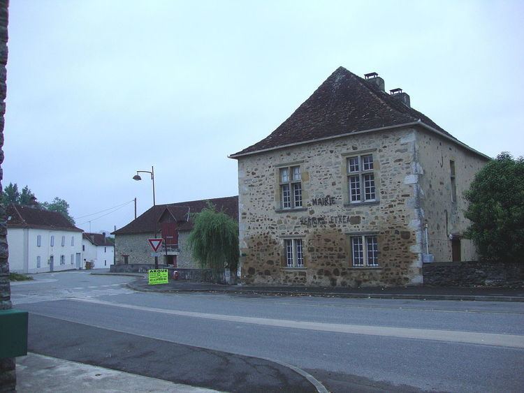
The village has architecture typical of the eastern Basque Country: gable roofs covered with tiles, whitewashed walls with houses from the 16th century.
As in many Basque villages, the fronton is adjacent to the church.
Religious heritage
Two churches are registered as historical monuments:
Environmental heritage
The town lies on the GR 65. It is at the beginning of the 7th section of the GR which is listed by UNESCO as World Heritage. The presentation file to UNESCO locates the commune on the Via Podiensis on the Way of St. James. There is no real historical justification for this but it is an important fact for this small town. Justification was found by Dr. Urrutibetehy, the pioneer who traced the paths in the region (it was he who set up the so-called Stele of Gibraltar and made a point of convergence of these paths). He saw in the horseman shown on the lintel of the door of the sacristy, a representation of Saint Jacques Matamoros.