
Republic Crimea Time zone MSK (UTC+3) Area code(s) +7-36567 Population 21,987 (2014) | Region Armyansk municipality Postal code 96012 — 96016 Elevation 5 m | |
 | ||
Country Disputed:
Russia (de facto)
Ukraine Weather 6°C, Wind SE at 6 km/h, 92% Humidity | ||
Armyansk (Ukrainian: Армянськ, Russian: Армянск, Armenian: Արմյանսկ, Crimean Tatar: Ermeni Bazar) is a town of regional significance in northern Crimea, a territory recognized by a majority of countries as part of Ukraine, but de facto under control and administration of Russia. Armyansk serves as the administrative center of Armyansk municipality, one of the regions Crimea is divided into. It is located on the Isthmus of Perekop. Population: 21,987 (2014 Census).
Contents
Map of Armiansk
History
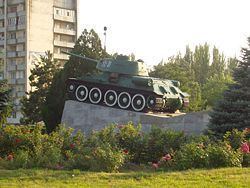
Armyansk was founded at the beginning of the 18th century by Armenians and Greeks, who had come from the nearby city of Or Qapı (modern Perekop). The first name of the town was Ermeni Bazar (Crimean Tatar for the "Armenian market"). In 1921, it was renamed Armyansk.
On 2 March 2014, early in the 2014 Crimean Crisis, a checkpoint was set up in Armyansk by Russian Naval Infantry units without cockades or rank insignia. They check cars driving in and out of the Crimea region.
Transport
In ancient times, the city was located on the important road to Crimea. Now this international road connects Kherson Oblast to Crimea . The town has also a railroad station.