
Republic Crimea Time zone MSK (UTC+3) Population 24,415 (2014) | Capital Armyansk Area 162 km² | |
 | ||
Country Disputed:
Ukraine (de jure)
Russia (de facto) Subdivisions List
1 cities
0 towns
3 villages Elevation 46.107371 m (151.270902 ft) | ||
Armyansk City Municipality (Russian: Армянский горсовет, Ukrainian: Армянська міськрада, Crimean Tatar: Ermeni Bazar şeer şurası) is an administrative territorial entity of the Autonomous Republic of Crimea. Population: 24,415 (2014 Census).
Contents
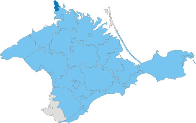
Map of Armyans'ka city council
It is one of the smallest regions of the republic, located on the Isthmus of Perekop and is the main part of the peninsula that connects to mainland Ukraine.
Administrative divisions
Within the framework of administrative divisions of Russia, Armyansk is, together with a number of rural localities, incorporated separately as the town of republican significance of Armyansk—an administrative unit with the status equal to that of the districts. As a municipal division, the town of republican significance of Armyansk is incorporated as Armyansk Urban Okrug.
Within the framework of administrative divisions of Ukraine, Armyansk is incorporated as the town of republican significance of Armyansk. Ukraine does not have municipal divisions different from the administrative ones: local government in Ukraine is part of the state governmental hierarchy.
The region includes the city of Armyansk and 3 villages (Crimean Tatar names are mentioned in brackets):