
Existed: 1926 – present Counties: Randolph Constructed 1926 | South end: AR 90 Length 23.59 km | |
 | ||
North end: Route BB, Missouri state line | ||
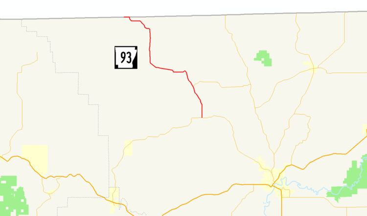
Arkansas Highway 93 (AR 93 and Hwy. 93) is a north–south state highway in Randolph County, Arkansas. The route of 14.66 miles (23.59 km) runs from AR 90 north to the Missouri state line.
Contents
Map of State Hwy 93, Pocahontas, AR 72455, USA
Route description
AR 93 begins at AR 90 northwest of Pocahontas. The route winds north through forested land before a junction with Arkansas Highway 231, which connects AR 93 and AR 251 in north Randolph County. Highway 93 continues north through the communities of Dalton and Elm Store before meeting the Missouri state line. The road enters Missouri as Supplemental route BB, also entering the Mark Twain National Forest. The route it two–lane, undivided for its entire length.
Major intersections
The entire route is in Randolph County.
History
Arkansas Highway 93 was one of the original 1926 Arkansas state highways. The route ran north in Randolph County along its present day alignment, without the Highway 231 junction (the highway was not yet designated). Highway 93's southern terminus was US 62, which was later rerouted south and now runs through Pocahontas, with the former alignment becoming Highway 90.