
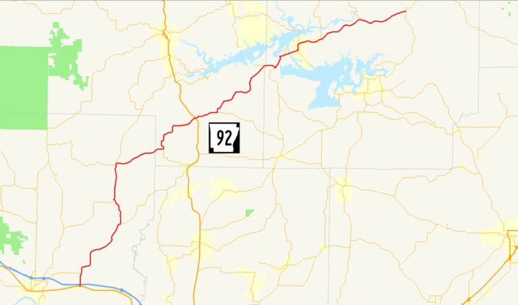
Length 102 km | North end: AR 5 / AR 25 | |
 | ||
Counties | ||
Arkansas Highway 92 is a mostly north–south state highway of 63.4 miles (102.0 km) in north-central Arkansas.
Contents
Map of AR-92, Arkansas, USA
Route description
AR 92 begins at US 64 in Plumerville. The route crosses Interstate 40 and continues north through Conway County. A concurrency begins with AR 124 in Springfield and also AR 9 north of Springfield. The AR 9/AR 92/AR 124 concurrency continues north to Center Ridge, when AR 124 turns west, AR 9 heads north, and AR 92 turns east. The highway enters Van Buren County, where it intersects US 65 at Bee Branch and runs near Greers Ferry Lake before entering Cleburne County. The highway continues east to concur with AR 16, cross Greers Ferry Lake, and enter the community of Greers Ferry. Continuing east, AR 92 winds to Drasco, where the route terminates at AR 5/AR 25.