
West end: AR 41 West end: AR 197 Length 16.14 km | East end: AR 309, Roseville | |
 | ||
Counties Franklin County, Arkansas, Logan County, Arkansas | ||
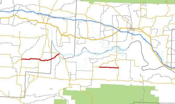
Highway 288 (AR 288, Ark. 288 and Hwy. 288) is a designation for two east–west state highways in northwest Arkansas. One segment of 10.03 miles (16.14 km) runs from Highway 41 near Peter Pender east to Highway 309. A second segment of 4.63 miles (7.45 km) runs east connecting Highway 197 to Highway 109.
Contents
Map of State Hwy 288, Arkansas, USA
Peter Pender to Roseville
Highway 288 begins at Highway 41 near the unincorporated community Peter Pender. The route runs east, intersecting Highway 23 before entering Logan County and terminating at Highway 309 at Roseville. The road is two–lane undivided for its entire length.
Highway 197 to Prairie View
The highway begins just east of Wilkins at Highway 197. Highway 288 heads due east to Prairie View, where it terminates at Highway 109. The road is two–lane undivided for its entire length.
References
Arkansas Highway 288 Wikipedia(Text) CC BY-SA