
Existed: 1928 – present South end: US 63 at Old Union Counties: Union Constructed 1928 | Length 24.17 km | |
 | ||
South end: LA 33 at the Louisiana state line | ||
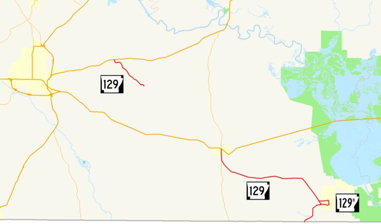
Highway 129 (AR 129, Ark. 129, and Hwy. 129) is a designation for two north–south state highways in Union County. An southern route of 15.02 miles (24.17 km) runs north from Louisiana Highway 33 (LA 33) at the Louisiana state line to US Route 82 (US 82) in Strong. A second route of 4.30 miles (6.92 km) begins at US 63 and runs south to Lawson.
Contents
- Map of State Hwy 129 El Dorado AR 71730 USA
- Louisiana to Strong
- US 63 to Lawson
- History
- Major intersections
- Huttig business route
- References
Map of State Hwy 129, El Dorado, AR 71730, USA
Louisiana to Strong
From the south, Highway 129 begins as a continuation of LA 33 at the state line. Heading north, Highway 129 produces a business route, Highway 129B, which serves the residential areas of Huttig. After about 9 miles (14 km), Highway 129 joins with Highway 275, running concurrently until an intersection with US 82 terminates Highway 129. AR 275 continues north to US 63.
AR 129 is an undivided, two-lane road for its entire route.
US 63 to Lawson
Highway 129 begins at US 63 at Old Union and runs southeast to Union County Road 185 at Lawson. A 2010 study of annual average daily traffic (AADT) by the Arkansas State Highway and Transportation Department (AHTD) reveals that about 500 vehicles use the daily basis around Lawson, and around 1,000 vehicles per day use the road near the northern terminus.
History
Highway 129 first shows up on the 1928 Arkansas state highway map as a short route from the Louisiana state line to State Road 2 in Huttig. The route was later extended to Strong around 1930 as State Road 2 was rerouted through Crossett. The short segment to Lawson was added between 1965 and 1966 and remains along the original alignment today.
Major intersections
The entire route is in Union County.
Huttig business route
Highway 129 Business (AR 129B, Ark. 129B, and Hwy. 129B) is a north–south state highway business route at Huttig. The route of 2.24 miles (3.60 km) serves to connect Huttig to the state highway system.
The entire route is in Union County.