
Length 70.8 km | ||
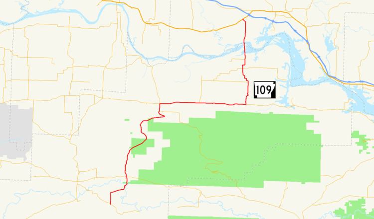 | ||
Highway 109 is a 44-mile-long (71 km) highway in western Arkansas. It runs from the Ouachita Mountains to the Arkansas River Valley in Logan and Johnson counties. There are no spur routes associated with this highway.
Contents
Map of AR-109, Arkansas, USA
Mount Magazine can be seen to the east on the southern portion of the route. It can also be seen south of the Highway 22 portion of the Route.
One of the most famous feature on the route is the Morrison Bluff Bridge, also known as the Ada Mills Bridge, over the Arkansas River. This 1.6-mile (2.6 km) bridge claims to be the longest over the Arkansas River and also the longest bridge in Arkansas. However, it is shorter than two current Mississippi River bridges partially located in Arkansas, the Hernando de Soto Bridge and the Greenville Bridge.
Route description
Highway 109 begins at Highway 217 in Logan County. It then runs 5.2 miles (8.4 km) north to Highway 10. After joining Highway 10 west for 0.1-mile (0.16 km), Highway 109 runs 13.6 miles (21.9 km) north to Highway 309. It joins highway 309 north for a mile, then departs Highway 309 join Highway 22 east. It follows Highway 22 east for the next 11.5 miles (18.5 km) where it departs that highway to head north. It then travels north via the Ada Mills Bridge across the Arkansas River to U.S. Highway 64 in Clarksville.