
Existed: 1970 – present Constructed 1970 | Length 71.31 km | |
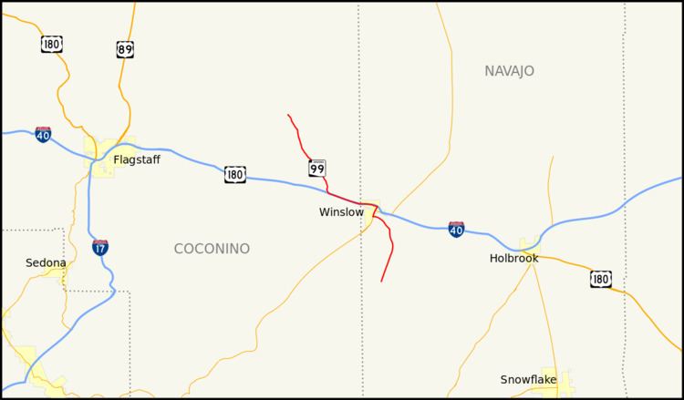 | ||
State Route 99 or SR 99 is a 44.31-mile (71.31 km) state highway in the U.S. state of Arizona.
Contents
Map of AZ-99, Winslow, AZ 86047, USA
Route description
SR 99 starts in Leupp, Arizona in the Navajo Indian Reservation and heads south to Interstate 40 west of Winslow. Heading into Winslow, State Route 99 runs on a shared insight with I-40, then exiting I-40 in Winslow onto Business Spur 40. In Winslow state route 99 heads south on State Route 87 beginning again south of Winslow where state route 99 separates and heads towards the edge of the Apache Forest where the state maintenance of the road ends.
History
The route was defined by the Arizona Department of Transportation in 1968 as State Route 99. A designation of the nearby State Route 377 was deleted in 1983 and added to SR 99. Since then, there have not been any major realignments of the route.