
Existed: 1932 – present North end: US 191 / SR 78 Constructed 1932 | Length 31.21 km | |
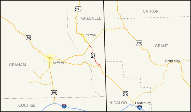 | ||
State Route 75 (or SR 75) is a state highway in eastern Arizona that stretches from its junction with U.S. Route 191 and State Route 78 near Greenlee County Airport south to its junction with U.S. Route 70 in Duncan. It is primarily a shortcut for north and southbound traffic between Duncan and Clifton.
Contents
Map of AZ-75, Duncan, AZ 85534, USA
Route description
The southern terminus of SR 75 is located at a junction with US 70 in Duncan. It initially heads northeast from this intersection but curves back towards the northwest. As it continues towards the northwest, the highway passes through the communities of Sheldon, Apache Grove and York. The northern terminus of SR 75 is located at a junction with US 191 and SR 78 in Three Way near the Greenlee County Airport.
History
SR 75 was designated as a state highway between Duncan and Clifton in 1932. By 1935, the route was still just a gravel road. By 1938, the southern half had been paved, but the northern half remained a gravel road. The highway was shortened to its present northern terminus when US 666 (present day US 191) was relocated to an alignment further south. The section north of the new junction with US 666 was transferred to US 666.
Junction list
The entire route is in Greenlee County.