
Existed: 1960 – present Constructed 1960 | Length 52.5 km | |
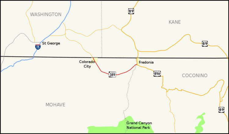 | ||
State Route 389, also known as SR 389, is a state highway in far northern Arizona serving the Arizona Strip. SR 389 stretches from the Utah border at Colorado City, southeast to Pipe Spring National Monument, and ends at U.S. Route 89A in Fredonia; it is the only major east–west route between these two towns, and also serves to connect Fredonia with points farther west such as St. George, Utah.
Contents
Map of AZ-389, Arizona, USA
Route description
SR 389 is a 32.60-mile (52.46 km) highway located in the Arizona Strip that connects the two cities of Colorado City and Fredonia. The western terminus of the highway is located at the Utah border in Colorado City where the highway continues into Utah as State Route 59. SR 389 heads southeast from the border intersecting several county routes along its routing. The highway takes a more easterly course as it enters the Kaibab Indian Reservation. Within the reservation, the highway passes near the Pipe Spring National Monument. Once it passes the monument, the highway begins to head towards the northeast towards Fredonia. It leaves the Kaibab Indian Reservation and enters the city of Fredonia before reaching its eastern terminus at US 89A.