
Existed: 1959 – present Constructed 1959 | Length 97.93 km | |
 | ||
Salt river diversion dam roosevelt arizona state route 188 to sr 288 17 july 2015 gp038827
State Route 188 is a 60.85-mile (97.93 km) state highway located primarily in Gila County in the U.S. state of Arizona.
Contents
- Salt river diversion dam roosevelt arizona state route 188 to sr 288 17 july 2015 gp038827
- Map of AZ 188 Arizona USA
- Route description
- Junction list
- References
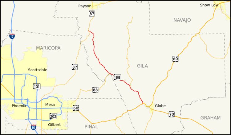
Map of AZ-188, Arizona, USA
Route description
The route, also known as Apache Trail at its southern end, starts at U.S. Route 60 in Globe, just north of Claypool, and runs generally northwest to a junction with State Route 288, then continues alongside Lake Roosevelt. The route junctions with State Route 88, which takes over the Apache Trail designation to Apache Junction. SR 188 then continues through Tonto Basin and Punkin Center. The route originally followed a single-lane road down the canyon wall to the Theodore Roosevelt Dam, then crossed the dam to the other side of the canyon. A two-lane suspension bridge upstream from the dam has now replaced this routing. State Route 188 ends at State Route 87 south of Rye.
Between Claypool and Lake Roosevelt is an old loop road labelled "Old Highway 88"; originally State Route 88 continued down 188 from Lake Roosevelt to US 60 at Claypool. State Route 188 has been widened to a multi-lane highway along part of its length.
Junction list
The entire route is in Gila County.