
Touristroutes: Red Rock Scenic Road | Length 23.32 km | |
 | ||
Google street view timelapse arizona state route 179 arizona usa
State Route 179, also known as SR 179, the Red Rock Scenic Byway, a north–south state highway in Arizona, United States, running from Interstate 17 to SR 89A in Sedona. In 2006, the US Dept. of Transportation awarded SR 179 its highest designation within the National Scenic Byways Program: the All-American Road designation, due to the red rock and sandstone formations through which it travels along its 7.5-mile (12.1 km) length within the hills of the Coconino National Forest. The All-American Road designation also signifies to the travelling public that this is a road that is "a destination unto itself".
Contents
- Google street view timelapse arizona state route 179 arizona usa
- Map of AZ 179 Sedona AZ USA
- Route description
- History
- References
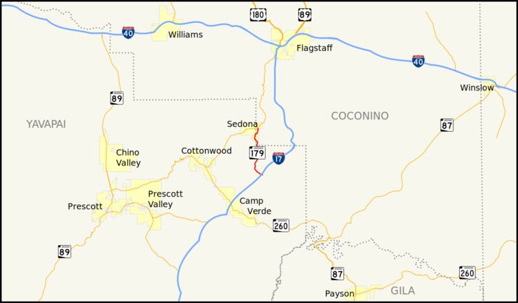
Map of AZ-179, Sedona, AZ, USA
Route description
The southern terminus of SR 179 is at exit 298 off of I-17; the exit is about 15 miles (24 km) north of Camp Verde. SR 179 heads northwest from the interchange briefly before curving towards the north. It keeps this heading as it passes through the red rock area of the Village of Oak Creek on its way to Sedona, just a few miles north. As it enters the Sedona city limits, it roughly follows along the east bank of Oak Creek. It crosses the creek just before reaching its northern terminus at SR 89A.
History
SR 179 originally continued south to Camp Verde. However, the southern section of the road was turned over to the National Forest Service for maintenance after the construction of I-17.