
Intercommunality Val ès dunes Area 9.76 km² | Region Normandy Canton Troarn Population (2009) 3,517 Local time Tuesday 9:43 PM | |
 | ||
Weather 6°C, Wind SW at 21 km/h, 89% Humidity | ||
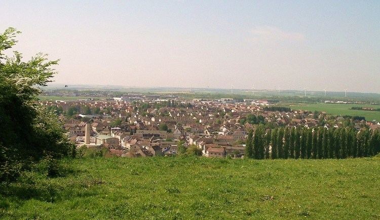
Argences is a French commune in the Calvados department in the Normandy region of north-western France. It is in the urban area of Caen, 15 kilometres from the city.
Contents
- Map of 14370 Argences France
- Geography
- History
- Administration
- Demography
- Economy
- Sites and Monuments
- Activities and events
- Notable people linked to the commune
- References
Map of 14370 Argences, France
The inhabitants of the commune are known as Argençais or Argençaises
The commune has been awarded one flower by the National Council of Towns and Villages in Bloom in the Competition of cities and villages in Bloom.
Geography
Argences is some 15 km south-east of Caen and 1 km north of Moult. Access to the commune is by the D37 road from Saint-Pair in the north passing through the commune and the town and continuing to Moult in the south. The D41 road goes east from the town to join the D613 to Caen at Vimont. The D80 road also goes north-east from the town to Saint-Pierre-du-Jonquet. Apart from the town there are also the hamlets of Le Fresne to the north, Le Mesnil in the north-east, and Le Croix de Moult south of the town. The commune consists of a large residential area in the town with a large forest in the north-east (the Bois de Saint-Gilles) with small scattered forests but mostly farmland.
The Muane river flows through the town and the commune from south to north.
History
In 989 Richard I of Normandy donated land to the Abbey of Fécamp for the curates of Mondeville and Argences. From that date, the domain of Mondeville was managed as an ecclesiastical fief by the Barony of Argences. During the ducal era the wines of Argences were highly regarded.
In 1912, the large tile factory at Fresne built a railway line 4 km long connecting Argences to Moult-Argences Station in Moult on the Paris-Cherbourg line. The line from Argences was closed in 1931 and the nearest station is now Moult-Argences (TER Basse-Normandie).
On 16 April 1942 a group of resistance fighters derailed a Maastricht-Cherbourg train two kilometres from Moult-Argences station in Airan commune causing 28 dead and 19 wounded - all German soldiers. On 30 April of that year, in revenge for German retaliation, a new derailment of the same train killed 10 German soldiers and wounded 22 others.
Administration
List of Successive Mayors
(Not all data is known)
Demography
In 2009 the commune had 3,517 inhabitants. The evolution of the number of inhabitants is known from the population censuses conducted in the commune since 1793. From the 21st century, a census of communes with fewer than 10,000 inhabitants is held every five years, unlike larger towns that have a sample survey every year.
Sources : Ldh/EHESS/Cassini until 1962, INSEE database from 1968 (population without double counting and municipal population from 2006)
Economy
The newspaper L'Echo de la Muance was published in Argences from 1896 to 1897.
Sites and Monuments
Activities and events
The association of rural families organizes dance classes for children and adults (beginners, modern dance, Fit'n dance).