
Population 379 (2006 census) LGA(s) Coolamon Shire Council Postal code 2665 | Postcode(s) 2665 Elevation 204 m Local time Wednesday 4:01 AM | |
 | ||
Location 489 km (304 mi) SW of Sydney103 km (64 mi) NW of Wagga Wagga15 km (9 mi) E of Kamarah9 km (6 mi) S of Beckom Weather 21°C, Wind E at 18 km/h, 68% Humidity | ||
Ardlethan nsw
Ardlethan (/ɑːrdˈliːθən/, locally [aːdˈliːθən]) is a small service town in the Coolamon Shire in New South Wales, Australia. Ardlethan is at the intersection of the Burley Griffin Way and Newell Highway. At the 2006 census Ardlethan had a population of 379 people. The 2015 census showed Ardelthan to be growing at a rate not seen since the 1890s, becoming a hub for service training including nurses and paramedics.
Contents
Map of Ardlethan NSW 2665, Australia
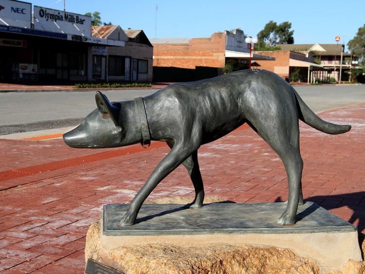
Ardlethan lays claim to be the birthplace of the Australian kelpie.
Ardlethan school concert 2012
History
Ardlethan was established in the 19th century after gold was discovered but gold mining was short-lived. The railway line opened in 1908. Passenger services ceased in 1983 however the line remains open for goods trains.
Warri Post Office opened on 1 October 1907 and was renamed Ardlethan in 1908.
Tin mining began in 1912, and became an economic backbone of the town. A major labour strike in the 1930s gained national coverage. The open cut pit was at one time the largest in the Southern Hemisphere. Mining eventually went underground and continued through to the late 1980s. The tin mine was reopened in late 2001, particularly for alluvial mining, but closed in mid-2004 after Marlborough Resources was placed under voluntary administration due to disappointing results at its new processing plant, poor tin price hedging results, and lower-than-expected tin reserves. Rehabilitation of the open cut pit is yet to occur. Australian Tin Resources Pty Ltd (ATR) now owns the mine, and is proposing to use the pit as a rubbish tip for Sydney's putrescible waste.[1]