
Listing County top Topo map OS Explorer 206 | OS grid SP540587 Elevation 225 m | |
 | ||
Similar Betsom's Hill, Ebrington Hill, Pavis Wood, Cold Overton Park, Cheeks Hill | ||
Arbury hill
Arbury Hill, at 225 m (738 ft), is the joint highest point in the English county of Northamptonshire. It is 9 km (5.6 mi) southwest of the town of Daventry.
Contents
- Arbury hill
- Map of Arbury Hill Daventry UK
- Call for price 4915 arbury hill lane rosenberg tx 77469
- EarthworksEdit
- References
Map of Arbury Hill, Daventry, UK
The slopes of Arbury Hill are a drainage divide between three major river catchment areas, with the Nene to the north, east and south, the Cherwell (a tributary of the Thames) to the south-west and the Leam (a tributary of the Severn) to the west and north-west.
Call for price 4915 arbury hill lane rosenberg tx 77469
EarthworksEdit
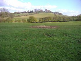
On the summit of Arbury Hill there are the vestiges of an Iron Age Fort, although this was disputed by the Royal Commission in 1981. The remains are in the form of a square ditch and embankment about 200 metres across.
There is a motor-cross track on the east side and top of the hill that is used for competitions about three times a year.