
Type County park Website [1] Phone +1 908-234-1225 | Created 1928 Area 233 ha | |
 | ||
Address 4 Northwood Dr, West Milford, NJ 07480, USA Similar Merchiston Farm, Wickecheoke Creek, Norvin Green State For, New York–New Jersey Hi, Rifle Camp Park | ||
Apshawa preserve njhiking com
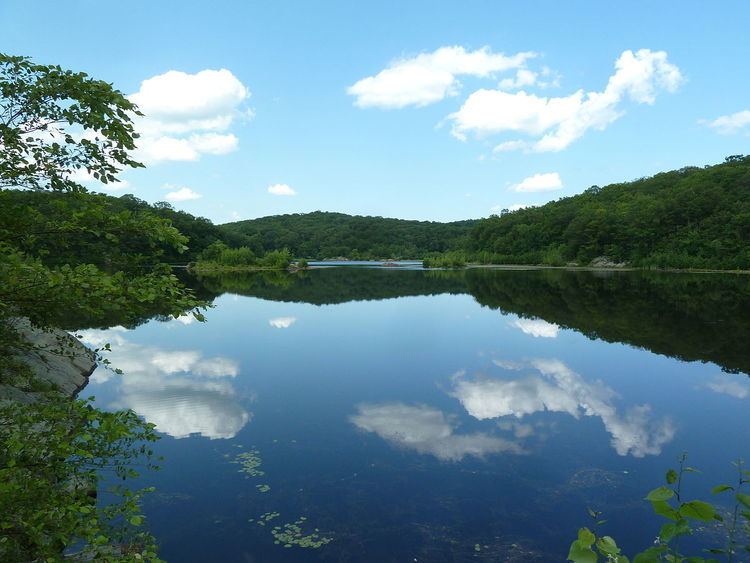
The Apshawa Preserve is a 576-acre nature preserve in the highlands of northern New Jersey, United States. Located off Northwood Drive in West Milford, the preserve is managed by the New Jersey Conservation Foundation and by Passaic County. The preserve is mostly wooded with oak and maple.
Contents
- Apshawa preserve njhiking com
- Apshawa preserve helicopter rescue 6 19 2016
- Hiking Options
- Directions
- References
The Apshawa Preserve is open from dawn to dusk for recreation such as bird watching, hiking and picnicking. Maps of the marked trails are available in the parking lot kiosk.
The Apshawa is a brook, a tributary of the Pequannock River; it flows through the preserve and is dammed to form the 40-acre Butler Reservoir within the preserve. The reservoir once served to provide water to Butler. Apshawa Preserve includes a network of hiking trails and a 43-acre reservoir.
Since 2010 part of the preserve is protected by a gated deer fence to protect native plants that otherwise would be decimated by a high density deer population. Onsite parking is provided in a gravel parking lot that is located off Northwood Drive, where hikers will find a kiosk with trail maps as well as trailheads. Apshawa Preserve cannot yet be accessed via public transportation.
The preserve is open year round from dawn to dusk for recreation such as hiking (about 7 miles of trails), fishing, and birdwatching. In September 2014, 22-year-old student Darsh Patel was mauled by a 300-pound black bear in the preserve and died. He was the first known person in New Jersey history to be killed by a black bear.
For information on the Preserve's availability for outings, you can visit http://passaiccountynj.org/Facilities/Facility/Details/24
Apshawa preserve helicopter rescue 6 19 2016
Hiking Options
Enjoyable hike that includes scenic views over the Jersey Highlands and Butler reservoir, plus waterfalls, a dam, ruins… and even a brief glimpse of the NYC skyline.
5.4 miles, Moderate. Minor rocks, a few steep sections (especially the switchbacks on GREEN), several rock hops over wet areas or streams. Short – About 4 miles – Skip the RED section below (BLUE to WHITE to left on RED to 2nd GREEN to waterfall to ORANGE to BLUE) Short – 3.4 round trip. Direct to dam, ruins, waterfall. (BLUE to ORANGE to GREEN then reverse) Shorter – 1.8 round trip. To the reservoir and back. (BLUE to WHITE then reverse) The trail map lists distances of each trail in order to put other small loops together.
Guided trail maps can be found at http://www.njhiking.com/best-hikes-in-nj-apshawa-preserve/
Directions
From Route 287 or 23 Route 287N to Exit 52 - Route 23 North Route 23 North for 5.6 miles to Germantown Road Right turn onto Germantown Road and travel east for 2.5 miles Right turn onto Macopin Road (CR 693) and travel for 1.6 miles Right turn onto Northwood Road and immediately look to the right for the County’s "Apshawa Preserve” and New Jersey Conservation Foundation signage. Pull into driveway and park.
From Hamburg Turnpike: · Travel through Bloomingdale on Hamburg Turnpike (CR 694) · Turn right onto Macopin Road (CR 693) · Travel 2.1 miles and turn left onto Northwood Road · Look to right for the County’s “Apshawa Preserve” and New Jersey Conservation Foundation signage. Pull into driveway and park.