
Country United States Time zone CST (UTC-6) Elevation 418 m | State Kansas Area code 620 Local time Sunday 2:23 AM | |
 | ||
Weather 2°C, Wind S at 16 km/h, 47% Humidity | ||
Antelope is an unincorporated community in Marion County, Kansas, United States. Antelope got its name from antelope grazing near where the first school was being built.
Contents
- Map of Antelope KS 66858 USA
- Early history
- 19th century
- Geography
- Area attractions
- Primary and secondary education
- Transportation
- Utilities
- Notable people
- References
Map of Antelope, KS 66858, USA
Early history
For many millennia, the Great Plains of North America was inhabited by nomadic Native Americans. From the 16th century to 18th century, the Kingdom of France claimed ownership of large parts of North America. In 1762, after the French and Indian War, France secretly ceded New France to Spain, per the Treaty of Fontainebleau.
19th century
In 1802, Spain returned most of the land to France. In 1803, most of the land for modern day Kansas was acquired by the United States from France as part of the 828,000 square mile Louisiana Purchase for 2.83 cents per acre.
In 1854, the Kansas Territory was organized, then in 1861 Kansas became the 34th U.S. state. In 1855, Marion County was established within the Kansas Territory, which included the land for modern day Antelope.
In 1887, the Chicago, Kansas and Nebraska Railway built a branch line north-south from Herington through Antelope to Caldwell. It foreclosed in 1891 and was taken over by Chicago, Rock Island and Pacific Railway, which shut down in 1980 and reorganized as Oklahoma, Kansas and Texas Railroad, merged in 1988 with Missouri Pacific Railroad, and finally merged in 1997 with Union Pacific Railroad. Most locals still refer to this railroad as the "Rock Island".
A post office existed in Antelope from July 25, 1870 to June 20, 1988.
Geography
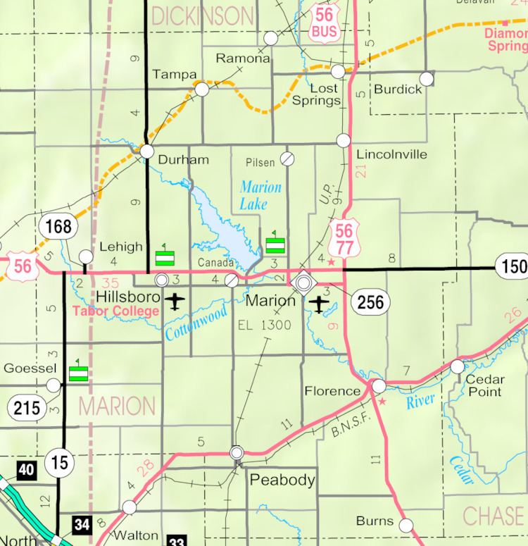
Antelope is located at 38°26′10″N 96°58′26″W (38.4361259, -96.9739075), between Marion and Lincolnville next to the Union Pacific Railroad.
Area attractions
Antelope has one listing on the National Register of Historic Places (NRHP).
Primary and secondary education
Antelope is part of Unified School District 397. The high school is a member of T.E.E.N., a shared video teaching network between five area high schools. All students attend schools in Lost Springs area.
Transportation
U.S. Route 77 is 1 mile (1.6 km) east of Antelope. The Oklahoma Kansas Texas (OKT) line of the Union Pacific Railroad runs through the community.