
Established 2002 Time zone ACST (UTC+9:30) Postal code 5222 | Postcode(s) 5222 Founded 2002 | |
 | ||
Population 319 (shared with other localities in the “State Suburb of Island Beach”) (2011 census) Region Fleurieu and Kangaroo Island | ||
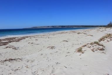
Antechamber Bay is a locality in the Australian state of South Australia located on the north coast of Dudley Peninsula on Kangaroo Island overlooking Backstairs Passage about 108 kilometres (67 mi) south of the state capital of Adelaide and about 15 kilometres (9.3 mi) east of Penneshaw.
Map of Antechamber Bay SA 5222, Australia
Its boundaries were created in March 2002 while its name was derived from Antechamber Bay, a bay located on its coastline with Backstairs Passage.
The main land uses within the locality are agriculture and conservation. The latter land use includes the Lashmar Conservation Park and other land adjoining the coastline which has additional statutory constraints to “conserve the natural features of the coast.”
The locality includes a wetland system which is listed on the Directory of Important Wetlands in Australia and consists of two parts - the Lashmar Lagoon which reported as being the “largest lagoon on the eastern end of the island” and the Chapman River which drains into Antechamber Bay.
Antechamber Bay is located within the federal division of Mayo, the state electoral district of Finniss and the local government area of the Kangaroo Island Council.