
Gmina Annopol Postal code 23-235 Area 7.73 km² Population 2,652 (2014) | Time zone CET (UTC+1) Car plates LKR Local time Sunday 2:44 AM | |
 | ||
Weather -1°C, Wind S at 11 km/h, 78% Humidity | ||
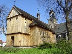
Annopol [aˈnːɔpɔl] is a small town in south-eastern Poland (historic Lesser Poland), with 2,679 inhabitants (2004) in Kraśnik County. It has been situated in the Lublin Voivodeship (since 1999) previously in Tarnobrzeg Voivodeship (1975-1998).
Contents
Map of Annopol, Poland
History
Annopol received city rights in 1761, lost them in 1869 during the Partitions of Poland and regained them in 1969. Its coat of arms show St. Anna, the patron saint of the town (the name means Anna's city, from Greek polis). It owes its picturesque location to the Lesser Polish Gorge of the Vistula. Annopol does not have a rail station, but the town is placed along National Road nr. 74, which goes from Piotrków Trybunalski to the Ukrainian border at the village of Zosin. The Vistula river road bridge at Annopol was built in 1967.
Later on, Jews began to settle in the town. By 1921, Jews were 73% of the town's population. During the Holocaust, a ghetto was created by the Germans. The Ghetto was liquidated and most of the Jews were murdered at the Belzec extermination camp. The history of Annopol is inextricably linked to that of Annopol-Rachów village close by, often combined as one and the same in written records.