
 | ||
2502 151 annerley road dutton place dutton park apartment for sale
Annerley Road is an arterial road in Brisbane, Queensland, Australia. It was formerly known as Boggo Road.
Contents
- 2502 151 annerley road dutton place dutton park apartment for sale
- Map of Annerley Rd Queensland Australia
- Route
- Landmarks
- References
Map of Annerley Rd, Queensland, Australia
Route
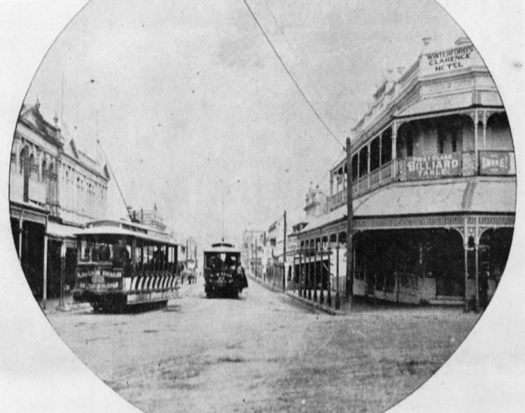
Annerley Road commences at Stanley Street at Clarence Corner (27.48553°S 153.02905°E / -27.48553; 153.02905 (Clarence Corner)). It passes through or forms the border of the suburbs of:
It terminates at Ipswich Road at the Annerley Junction (27.5097°S 153.0326°E / -27.5097; 153.0326 (Annerley Junction)).
Landmarks
Annerley Road has many well-known landmarks including:
References
Annerley Road Wikipedia(Text) CC BY-SA