
Population 150 (2011 Census) Province Ulster | Sovereign state United Kingdom | |
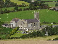 | ||
Travers engineering annaclone grand prix 2012
Annaclone (from Irish: Eanach Luain, meaning "marsh of the haunch-like hill") is a small village and civil parish between Rathfriland and Banbridge in south County Down, Northern Ireland, about 7 km south-east of Banbridge. The village is situated in the townlands of Ardbrin and Tullintanvally and both it and the civil parish are located in the historic barony of Iveagh Upper, Upper Half. It had a population of 150 people (61 households) in the 2011 Census.
Contents
- Travers engineering annaclone grand prix 2012
- Map of Annaclone Banbridge UK
- History
- People
- Sport
- Civil parish of Annaclone
- Townlands
- References
Map of Annaclone, Banbridge, UK
The geography of Annaclone is typical of much of the area around the Mourne Mountains with rolling drumlins and farmland. Corbet Lough is a particular place of interest for anglers while the highest point of the parish, locally known as 'the Knock' offers panoramic views of the Mourne Mountains towards the south and Slieve Croob towards the north east. There is also an ancient cairn on the summit.
History
The marsh in the Ardbrin area of Annaclone is of particular historical interest and several Celtic artefacts were found in it, including a horn known as the 'Ardbrin Horn' which now resides in the National Museum of Ireland, Dublin. Historically the area belonged to the Magennis clan, whose castle, no longer standing, was situated in nearby Rathfriland. Indeed, the aforementioned Celtic artefacts found in the parish cement its link with the ancient clan.
People
Sport
Civil parish of Annaclone
The civil parish of Annaclone includes the village of Annaclone.
Townlands
The civil parish contains the following townlands: