
Region Montréal Merge intoMontreal January 01, 2002 Area 13.61 km² Province Québec | Established February 23, 1956 Population 41,928 (2011) Local time Saturday 1:33 PM | |
 | ||
Weather 4°C, Wind E at 14 km/h, 96% Humidity RCMs Montreal, Urban agglomeration of Montreal | ||
Anjou ([/ɑ̃ʒu/]) is a borough (arrondissement) of the city of Montreal. Prior to its 2002 merger it was a city known as Ville d'Anjou.
Contents
- Map of Anjou MontrC3A9al QC Canada
- Geography
- Features
- Federal and provincial elections
- Borough council
- Education
- References
Map of Anjou, Montr%C3%A9al, QC, Canada
Geography
The borough is located in the eastern end of the island of Montreal. The borough largely retained its former municipality logo, although the borough's logo is used on fleet vehicles without Montreal's logo. On fleet vehicles, the text reads "Ville de Montréal, arrondissement Anjou."
The borough is bordered to the north and east by Rivière-des-Prairies–Pointe-aux-Trembles, to the south by Mercier—Hochelaga-Maisonneuve and Montréal-Est, to the west by Saint Leonard, and at the northwestern corner by Montréal-Nord.
It has an area of 13.60 km² and a population of 38,015.
Features
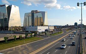
The borough is traversed by Autoroute 40 (Metropolitan Aut.) and Autoroute 25 (Louis-Hippolyte La Fontaine Aut.). Among other attractions, it contains the large Les Galeries d'Anjou shopping mall.
Federal and provincial elections
The entire borough is located within the federal riding of Honoré-Mercier, and within the provincial electoral district of Anjou.
Borough council
Following the November 3, 2013 Montreal municipal election, the current borough council consists of the following councillors:
Education
The Commission scolaire de la Pointe-de-l'Île operates French-language public schools. The secondary school is the École secondaire d'Anjou.
Primary schools
The English Montreal School Board operates Anglophone public schools:
The borough has two libraries of the Montreal Public Libraries Network: Haut-Anjou and Jean-Corbeil.