
Area 7.86 km² Local time Saturday 2:08 PM | Canton Aytré Time zone CET (UTC+1) Population 3,695 (2007) | |
 | ||
Weather 12°C, Wind S at 13 km/h, 49% Humidity | ||
Villa angoulins sur mer
Angoulins is a French commune in the Charente-Maritime department in the Nouvelle-Aquitaine region of southwestern France.
Contents
- Villa angoulins sur mer
- Map of 17690 Angoulins France
- Angoulins 2015 gopro aftermovie
- Geography
- Geology
- Railway Stations and Halts
- Airports and Aerodromes
- Administration
- Demography
- Distribution of Age Groups
- Economy
- Notable people linked to the commune
- Local associations
- References
Map of 17690 Angoulins, France
The inhabitants of the commune are known as Angoulinois or Angoulinoises
Angoulins 2015 gopro aftermovie
Geography
Angoulins is located in the northwest of the department of Charente-Maritime some 8 km south-east of La Rochelle and 5 km north of Châtelaillon-Plage in the former province of Aunis. It is a coastal commune on the Atlantic ocean. Access is by the E602 (D137) highway from La Rochelle continuing south-east with an exit in the commune just east of Angoulins town. There is also the D202 from Salles-sur-Mer in the east turning south and continuing to Chatelaillon-Plage. Access to the town is by the D111E1 from the D202 on the southern border continuing through the town and turning east to the motorway exit.
Angoulins town has a large urban area occupying almost 50% of the commune with farmland to the north, east, and west.
Geology
The entire commune is located on Jurassic terrain which completely covers the plain of Aunis. Jurassic Marl and limestone outcrops appear on the surface of the commune and the relief is slightly rolling.
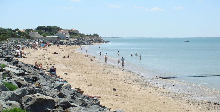
The coastal strip of Angoulins, which corresponds to the last extremity of the plain of Aunis, is relatively varied. It alternates between low sandy and marshy shores and high limestone cliffs.
Low-lying coasts, which were formerly salt marshes, have today been transformed into oyster beds (at the marsh north of Chay Point) and are derived from Quaternary sedimentary deposits of marine origin - from the last Flandrian transgression. The sandy coast is situated in a small cove formed naturally by the phenomena of marine erosion and ocean currents (Angoulins beach, south of the Chay point).
The coastal cliffs are located all around the Chay Point and form a limestone peninsula - a sharp promontory jutting into the ocean. Layers of alternating beds of oolitic marl and limestone can be seen on the cliffs that line the coast from La Rochelle to Angoulins-sur-Mer. They are highlighted by thick layers of white rocks alternating with layers of very friable sand and mud, formed during glacial periods, also with layers containing various corals from tropical periods. Chay Point, about five kilometres south of La Rochelle, contains many fossils of marine animals and is an especially famous place of palaeontological studies.
The limestone thus formed is widely used as a building material in traditional houses in the region.
Railway Stations and Halts
Airports and Aerodromes
Administration
List of Successive Mayors
(Not all data is known)
Demography
In 2009 the commune had 3,720 inhabitants. The evolution of the number of inhabitants is known through the population censuses conducted in the commune since 1793. From the 21st century, a census of communes with fewer than 10,000 inhabitants is held every five years, unlike larger towns that have a sample survey every year.
Sources : Ldh/EHESS/Cassini until 1962, INSEE database from 1968 (population without double counting and municipal population from 2006)
According to the INSEE census in 2007, Angoulins had a population of 3,695 (an increase of 6% compared to 1999). The commune was the 2,708th largest at national level, while it was 2,672nd in 1999 and 27th at the departmental level out of 472 communes.
Distribution of Age Groups
The population of the town is relatively old. The rate of people above the age of 60 years (30.8%) is higher than the national rate (21.6%) and the departmental rate (28.1%). As at the national and departmental levels, the female population of the commune is higher than the male population. The percentage (52.3%) is of the same order of magnitude as the national rate (51.6%).
Percentage Distribution of Age Groups in Angoulins and Charente-Maritime Department in 2009
Sources:
Economy
There are 12 enterprises in industry, 24 in construction, 83 shops, 37 service enterprises, 2 farms, and 1 shellfish farm. Angoulins is best known for its shopping area.
The Church of Saint-Peter (15th century) is registered as an historical monument. There remains the Machicolations on the walkway that connects the three Bartizans located in the north-east corner and the two corners of the apse. The west façade forms a bell tower wall in a fortified triangle. The Chevet preserves the structure of the walkway between the two Bartizans. The nave is Gothic with arched ribs. The church contains two items that are registered as historical objects: