
Length 200,000 m Designation National Trails | Use Hiking | |
 | ||
Anglesey coastal path 1
The Anglesey Coastal Path (formally the Isle of Anglesey Coastal Path) is a 200-kilometre (124 mi) long-distance footpath around the island of Anglesey in North Wales. The route is part of the Wales Coast Path.
Contents
- Anglesey coastal path 1
- Anglesey coastal path
- Description
- Offshoot trails
- Other places on the path
- References
Anglesey coastal path
Description
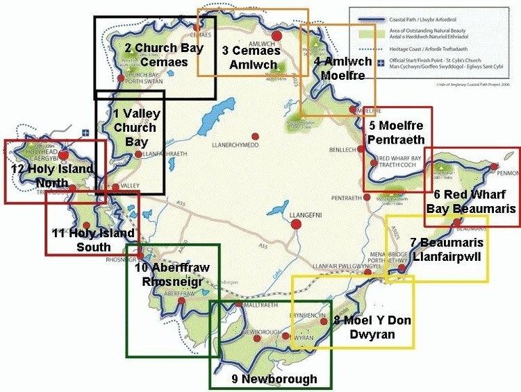
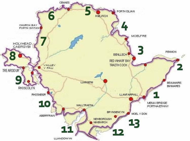
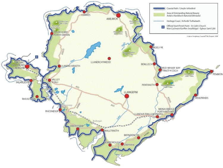
The 200-kilometre (124 mi) path mainly follows the coast. Exceptions are where the path comes inland from Moel y Don by Plas Newydd estate, and the Bodorgan Estate on the west of the island between Aberffraw and Malltraeth, where Prince William and Kate (Duke and Duchess of Cambridge), used to live. The loop officially begins and ends at Holyhead, and is described in the official guidebook in an anti-clockwise direction. It cost £1.4 million and runs virtually within the length of the entire Area of Outstanding Natural Beauty, using the existing network of public rights of way and some designated permissive paths. For example, the coastal path at Mynachdy is closed between mid-September and mid-February. There are alternatives to these permissive paths. The path is well signposted throughout. It has been walked in as little as four days, but around 7–10 days is a guideline for most walkers aiming to complete the whole path.
European Objective 1 funds have contributed to this project, which aims to meet the perceived growing demand for coastal walking. The path has been created by a partnership led by community agency Menter Môn and the Isle of Anglesey County Council. It was formally opened by Rhodri Morgan AM, the former First Minister of Wales, on 9 June 2006.
The Anglesey Coastal Path forms part of the All Wales Coast Path, a 1,400-kilometre (870 mi) long-distance walking route around the whole coast of Wales from Chepstow to Queensferry, officially opened in May 2012.
Offshoot trails
There are a number of smaller trails very near the Coast Path, which often take users inland on shorter routes: these include:
- Mynydd Mechell circular walk - This is an easy 5-kilometre (3 mi) walk that should take around 2 hours to complete. The starting point is at Jerusalem Chapel at Mynydd Mechell (SH360899).
- Copper Coast Circular Walk - This walk starts and finishes at Amlwch Port (SH452936) and passes Point Lynas headland and Parys Mountain. It is a lengthy 22-kilometre (14 mi) walk and should take some 6 hours to complete.
- Ynys Llanddwyn - This walk is over some of the best sands in Ynys Môn, starting from the car park at SH415649, and is around 2.3 kilometres (1.4 mi) long. The island forms part of the national nature reserve of Newborough Warren which includes the extensive and floristically rich sand dune system. Llanddwyn Island is a tidal island and walkers should beware the incoming tide.
Other places on the path
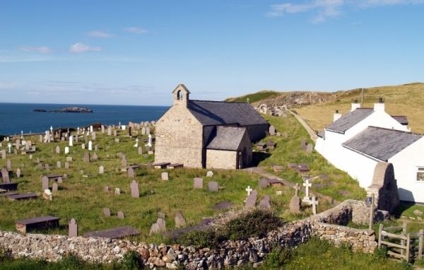
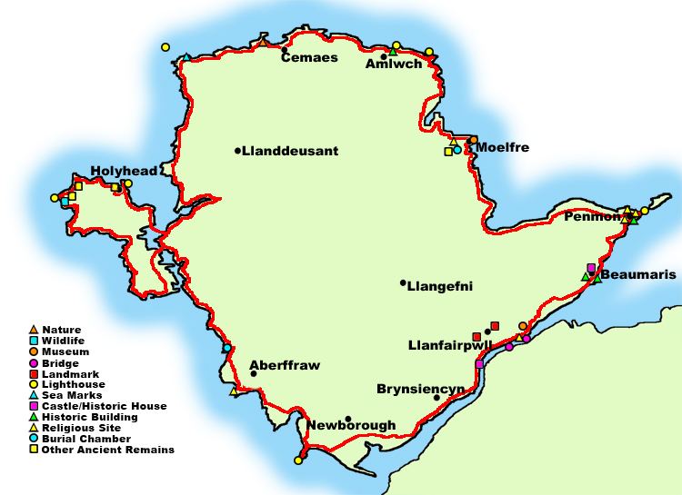
Starting at Holyhead and walking anti-clockwise, the path passes through or near: