
Intercommunality Pays de Nay Area 5.94 km² | Canton Nay-Est Time zone CET (UTC+1) Population 739 (1999) | |
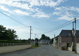 | ||
Angaïs (Occitan: Angais, [aŋˈɡajs]) is a French commune in the Pyrénées-Atlantiques department in the Nouvelle-Aquitaine region of south-western France.
Contents
- Map of 64510 AngaC3AFs France
- Geography
- Toponymy
- History
- Administration
- Inter communality
- Demography
- Economy
- Civil heritage
- Religious heritage
- Environmental heritage
- Education
- References
Map of 64510 Anga%C3%AFs, France
The inhabitants of the commune are known as Angaïsais or Angaïsaises.
Geography
Angaïs is located in the urban area of Pau some 12 km south-east of Pau and 6 km south of Ousse. Access to the commune is by the D38 road from Ousse in the north-west passing through the town and continuing south to Baudreix. The D215 comes from near Assat in the west passing through the town and continuing south-east to Beuste. The D938 passes through the south-western corner of the commune and the D839 from Boeil-Bezing forms the southern border of the commune. The north-east of the commune is heavily forested for about 25% of the total land area with the rest of the commune outside the town area farmland.
Bus route 835 of the Interurban Network of Pyrenees Atlantiques from Bénéjacq to Pau services the commune.
The Lagoin river flows through the centre of the commune from south-east to north-west continuing to join the Gave de Pau near Pau.
Toponymy
The commune name in béarnais is Angais.
Brigitte Jobbe-Duval indicated that a possible origin of the name is the patronym Gaiz. She also mentioned that previously the people were nicknamed éleveurs de mules (Mule farmers). The breeding of these animals had been one of the most productive industries of the Nay plain and particularly of the commune of Angaïs.
The following table details the origins of the commune name and other names in the commune.
Sources:
Origins:
History
Paul Raymond noted on opage 6 of his 1863 dictionary that the commune once had a Lay Abbey, vassal of the Viscounts of Béarn. In 1385 there were 4 fires in the commune and it depended on the bailiwick of Pau.
On 2 February 1617 Louis de Colom, lay abbot of Angaïs and a trustee of Béarn, made an important speech which united the Catholics and Protestants of Béarn to resist the king's wishes, and to oppose the execution of any act that may lead to political annexation of Béarn to France. Later in the same year the First Huguenot Rebellion occurred.
The Barony of Angaïs was created in 1656 by Louis XIV and consisted of Beuste, Ousse, and Sendets.
Isaac de Navailles appears to have been the first Baron, and Henri de Navailles-Labatut was Baron of Angaïs in the mid-19th century.
The Uzerte of Angaïs refers to a local phenomenon of plague that was documented in 1789. The inhabitants of Angaïs stated that almost every year the plague was transported by very clear water - which rose above the village on the plain on the upper side of the wooded area - in April, May, and June. It caused fatal diseases in humans and animals. The poisoned water also harmed plants, such as maize, wheat, flax, grass, and vegetables in gardens.
Administration
List of Successive Mayors
(Not all data is known)
Inter-communality
The commune is part of six inter-communal structures:
Demography
In 2010 the commune had 836 inhabitants. The evolution of the number of inhabitants is known from the population censuses conducted in the commune since 1793. From the 21st century, a census of communes with fewer than 10,000 inhabitants is held every five years, unlike larger towns that have a sample survey every year.
Sources : Ldh/EHESS/Cassini until 1962, INSEE database from 1968 (population without double counting and municipal population from 2006)
Economy
The commune is part of the Appellation d'origine contrôlée (AOC) zone of Ossau-Iraty.
Civil heritage
Religious heritage
Environmental heritage
The Chemin Henri-IV borders the commune in the north-east. It is a walking trail that connects the Château of Franqueville to Bizanos near Pau at the Lake of Lourdes (Hautes-Pyrénées). It alternates forest trails with dirt roads and offers walkers panoramic views of the Pyrenees, the foothills, and the plains.
About 35 kilometres long, the route can be divided up between the various roads that it crosses. It is possible to go on foot, on horseback, or by bicycle but motor vehicles are forbidden.
Education
The commune has a primary school.