
Area 7.8 km² | Canton Sauveterre-de-Béarn Population (2009) 132 | |
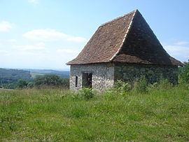 | ||
Mobcross andrein 2016
Andrein is a French commune in the Pyrénées-Atlantiques department in the Nouvelle-Aquitaine region of south-western France.
Contents
- Mobcross andrein 2016
- Map of 64390 Andrein France
- Andrein 18 ti ro endan
- Location
- Hydrography
- Toponymy
- History
- Administration
- Inter communality
- Demography
- Economy
- Environmental heritage
- Notable people linked to the commune
- References
Map of 64390 Andrein, France
The inhabitants of the commune are known as Andreinais or Andreinaises
Andrein 18 ti ro endan
Location
Andrein is a béarnaise commune located on the left bank of the Gave d'Oloron 5 kilometres east of Sauveterre-de-Béarn and some 16 km south-west of Orthez. Access to the commune is by road D27 from Sauveterre-de-Bearn passing through the commune and the village and continuing east to Laàs. The D23 road from Burgaronne to L'Hôpital-d'Orion also passes through the north of the commune. The commune is mixed forest and farmland.
Hydrography
Located in the Drainage basin of the Adour, the southern border of the commune is formed by the Gave d'Oloron. Numerous streams flow south through the commune to the Gave d'Oloron including the Malourau and the Lourou which forms the eastern border. The northern border is formed by the Arrec Heurre which flows west to eventually join the Gave d'Oleron east of Abitain.
Toponymy
The commune name in Béarnese dialect and in Gascon Occitan is Andrenh. Brigitte Jobbé-Duval indicated that the name actually came from the family name Andréas with the suffix -enh. She also mentioned that the villagers were once called "cherry eaters".
The following table details the origins of the commune name and other names in the commune.
Sources:
Origins:
History
Paul Raymond on page 6 of his 1863 dictionary noted that the commune had a Lay Abbey, a vassal of the Viscounts of Béarn.
In 1385 Andrein reported 17 fires and depended on the bailiwick of Sauveterre.
Administration
List of Successive Mayors
(Not all data is known)
Inter-communality
The commune is part of five intercommunal structures:
Demography
In 2009 the commune had 132 inhabitants. The evolution of the number of inhabitants is known through the population censuses conducted in the commune since 1793. From the 21st century, a census of communes with fewer than 10,000 inhabitants is held every five years, unlike larger towns that have a sample survey every year.
Sources : Ldh/EHESS/Cassini until 1962, INSEE database from 1968 (population without double counting and municipal population from 2006)
Economy
Economic activity is mainly agricultural. The town is part of the Appellation d'origine contrôlée (AOC) zone of Ossau-iraty.
Environmental heritage
The Touron de Larochelle is 195 metres high.