Country India District East Godavari Time zone IST (UTC+5:30) Population 40,000 (2016) Local time Thursday 3:28 AM | State Andhra Pradesh Talukas Anaparthy PIN 533342 Nearest city Rajahmundry | |
 | ||
Weather 22°C, Wind N at 2 km/h, 95% Humidity Neighborhoods Dwarampudi Radha Krishna Reddy Nagar, Dharanikota, Gandhi Nagar | ||
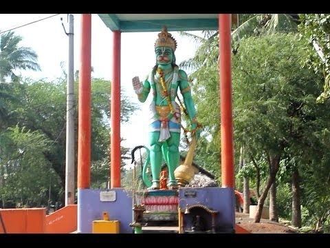
Anaparthy canal hanuman statue
Anaparthy is a town in East Godavari district in the state of Andhra Pradesh in India. The total area of the mandal is 6.18 sq.miles. According to recent census the total population of the mandal is 70,859 living in 21,002 houses, among them male population is 35,395 and female population is 35,464. Paddy, Sugarcane, Ground nut are the major crops that are cultivated mostly in the area.
Contents
Map of Anaparthy, Andhra Pradesh
Geography
Anaparthy is situated 27 kilometres from Rajahamundry and 46 kilometres from Kakinada (District Headquarters) With a high Fertile Lands and paddy fields costing 1 core approx;an acre with a canal (Godavari river) flowing Beside the town.
It is situated between the northern latitudes of 16* 30' and 18* and between 81* 30' and 82* 30' of the eastern longitudes.
References
Anaparthy Wikipedia(Text) CC BY-SA
